Earthquake SOUTHERN ALASKA
Thu, 17 May 2018 13:38:41 GMT
Time7 years ago
Location
61.2600, -146.8400
Depth
0.0 KM
Event Summary
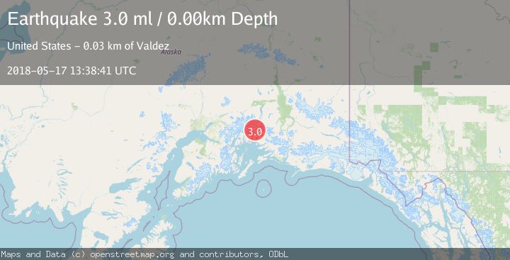
A 3.0 magnitude earthquake struck on SOUTHERN ALASKA, at Thu, 17 May 2018 13:38:41 GMT. Depth: 0km. Reviewed by NEIR seismologists, this minor quake occurred at a magnitude type of ml.
Magnitude
3.0
ml
Source
NEIR
Intensity
-
Agency Reports
1 Sources| Source | Magnitude | Depth | Time |
|---|---|---|---|
| NEIRPrimary | 3.0 | 0 km | 7 years ago |
Earthquake Details
AutomaticEvent IDemsc_NEIR_20180517_0000080
Tsunami PotentialNo
Magnitude Typeml
Nearest Places
- Divider Mountain1.9 km
- East Branch Columbia Glacier (not official)4.8 km
- Columbia Glacier5.6 km
- Ted Stevens Icefield8.2 km
- Cold King Camp8.5 km
Comments
Join the discussion about this event.
Latest Earthquakes
1.7Mag
western Texas
Time6 minutes ago
Depth3.42 km
SourceVYT (Automatic)
3.8Mag
Seram, Indonesia
Time8 minutes ago
Depth0.00 km
SourceVYT (Automatic)
1.6Mag
54 km WNW of Toyah, Texas
Time13 minutes ago
Depth0.00 km
SourceUSGS (Automatic)
2.2Mag
West Papua Region, Indonesia
Time15 minutes ago
Depth26.69 km
SourceBMKG
1.2Mag
WESTERN TURKEY
Time15 minutes ago
Depth7.00 km
SourceAFAD (Automatic)
Nearby Earthquakes
3.0Mag
SOUTHERN ALASKA
Time4 years ago
Depth24.00 km
SourceNEIC (Automatic)
1.8Mag
29 km NW of Valdez, Alaska
Time3 weeks ago
Depth27.00 km
SourceUSGS (Automatic)
3.0Mag
SOUTHERN ALASKA
Time1 year ago
Depth34.00 km
SourceNEIC (Automatic)
3.0Mag
SOUTHERN ALASKA
Time1 year ago
Depth31.20 km
SourceNEIC (Automatic)
2.2Mag
33 km NW of Valdez, Alaska
Time6 days ago
Depth22.10 km
SourceUSGS (Automatic)