Earthquake 29 km NW of Valdez, Alaska
Sat, 24 Jan 2026 17:01:23 GMT
Time2 days ago
Location
61.2850, -146.8040
Depth
27.0 KM
Event Summary
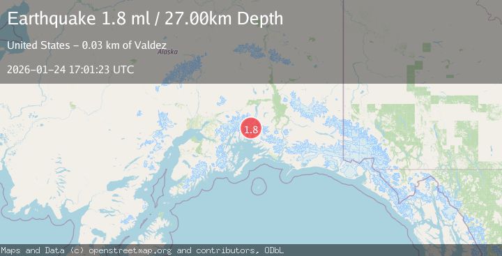
A 1.8 magnitude earthquake struck on 29 km NW of Valdez, Alaska, at Sat, 24 Jan 2026 17:01:23 GMT. Depth: 27km. Reviewed by USGS seismologists, this minor quake occurred at a magnitude type of ml.
Magnitude
1.8
ml
Source
USGS
Intensity
-
Agency Reports
1 Sources| Source | Magnitude | Depth | Time |
|---|---|---|---|
| USGSPrimary | 1.8 | 27 km | 2 days ago |
Earthquake Details
AutomaticEvent IDusgs_ak2026brnoki
Tsunami PotentialNo
Magnitude Typeml
Nearest Places
- Divider Mountain5.3 km
- Ted Stevens Icefield5.6 km
- Pandora Peak6.3 km
- Columbia Glacier6.8 km
- East Branch Columbia Glacier (not official)8.0 km
Comments
Join the discussion about this event.
Latest Earthquakes
1.1Mag
30 km NE of Los Alamos, CA
Time11 minutes ago
Depth4.17 km
SourceUSGS (Automatic)
1.2Mag
EASTERN TURKEY
Time11 minutes ago
Depth7.00 km
SourceAFAD (Automatic)
2.6Mag
Timor Region
Time14 minutes ago
Depth35.26 km
SourceBMKG (Automatic)
2.3Mag
Sumbawa Region, Indonesia
Time14 minutes ago
Depth10.00 km
SourceBMKG (Automatic)
2.5Mag
Flores Sea
Time15 minutes ago
Depth26.93 km
SourceBMKG (Automatic)
Nearby Earthquakes
1.8Mag
31 km NW of Valdez, Alaska
Time4 days ago
Depth22.60 km
SourceUSGS (Automatic)
1.4Mag
40 km NNW of Valdez, Alaska
Time18 hours ago
Depth43.80 km
SourceUSGS (Automatic)
2.6Mag
22 km N of Valdez, Alaska
Time1 day ago
Depth25.10 km
SourceUSGS (Automatic)
1.9Mag
37 km NNW of Valdez, Alaska
Time2 days ago
Depth36.10 km
SourceUSGS (Automatic)
1.7Mag
45 km NNW of Valdez, Alaska
Time3 days ago
Depth21.00 km
SourceUSGS (Automatic)