Earthquake SOUTHERN CALIFORNIA
Fri, 17 Jan 2020 13:06:21 GMT
Time6 years ago
Location
35.6500, -117.4800
Depth
9.0 KM
Event Summary
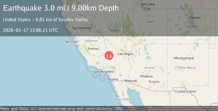
A 3.0 magnitude earthquake struck on SOUTHERN CALIFORNIA, at Fri, 17 Jan 2020 13:06:21 GMT. Depth: 9km. Reviewed by NEIR seismologists, this minor quake occurred at a magnitude type of ml.
Magnitude
3.0
ml
Source
NEIR
Intensity
-
Agency Reports
1 Sources| Source | Magnitude | Depth | Time |
|---|---|---|---|
| NEIRPrimary | 3.0 | 9 km | 6 years ago |
Earthquake Details
AutomaticEvent IDemsc_NEIR_20200117_0000095
Tsunami PotentialNo
Magnitude Typeml
Nearest Places
- 0.6 km
- 2.5 km
- 4.9 km
- 5.9 km
- 6.0 km
Comments
Join the discussion about this event.
Latest Earthquakes
2.5Mag
Antofagasta, Chile
Time1 minute ago
Depth2.81 km
SourceVYT (Automatic)
3.5Mag
Papua, Indonesia
Time1 minute ago
Depth231.93 km
SourceVYT (Automatic)
2.3Mag
Near North Coast of West Papua
Time2 minutes ago
Depth10.00 km
SourceBMKG
1.4Mag
5 km NNW of The Geysers, CA
Time3 minutes ago
Depth1.33 km
SourceUSGS (Automatic)
2.6Mag
Hungary
Time4 minutes ago
Depth1.95 km
SourceVYT (Automatic)
Nearby Earthquakes
3.0Mag
SOUTHERN CALIFORNIA
Time6 years ago
Depth1.00 km
SourceNEIC (Automatic)
3.0Mag
SOUTHERN CALIFORNIA
Time6 years ago
Depth0.00 km
SourceNEIR (Automatic)
1.3Mag
13 km SSW of Searles Valley, CA
Time1 week ago
Depth6.63 km
SourceUSGS (Automatic)
2.7Mag
SOUTHERN CALIFORNIA
Time1 month ago
Depth10.00 km
SourceNEIC (Automatic)
0.3Mag
14 km SW of Searles Valley, CA
Time1 week ago
Depth6.31 km
SourceUSGS (Automatic)