Earthquake PHILIPPINE ISLANDS REGION
Tue, 15 Dec 2020 22:05:53 GMT
Time5 years ago
Location
5.9900, 127.2400
Depth
78.0 KM
Event Summary
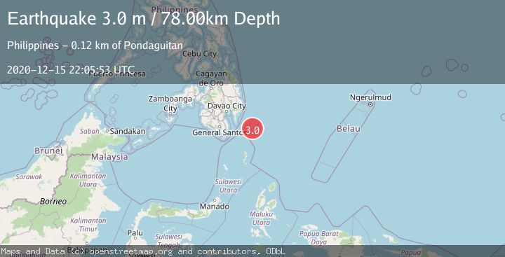
A 3.0 magnitude earthquake struck on PHILIPPINE ISLANDS REGION, at Tue, 15 Dec 2020 22:05:53 GMT. Depth: 78km. Reviewed by PIVS seismologists, this minor quake occurred at a magnitude type of m.
Magnitude
3.0
m
Source
PIVS
Intensity
-
Agency Reports
1 Sources| Source | Magnitude | Depth | Time |
|---|---|---|---|
| PIVSPrimary | 3.0 | 78 km | 5 years ago |
Earthquake Details
AutomaticEvent IDemsc_PIVS_20201215_0000176
Tsunami PotentialNo
Magnitude Typem
Nearest Places
- Tanjung Dapapa86.1 km
- Desa Pulau Miangas87.1 km
- Pulau Miangas87.1 km
- Kecamatan Miangas87.1 km
- Miangas87.8 km
Comments
Join the discussion about this event.
Latest Earthquakes
2.8Mag
Germany-Czech Republic border region
Time4 minutes ago
Depth0.00 km
SourceVYT (Automatic)
3.9Mag
Molucca Sea
Time5 minutes ago
Depth0.00 km
SourceVYT (Automatic)
3.4Mag
Kenai Peninsula, Alaska
Time6 minutes ago
Depth38.57 km
SourceVYT (Automatic)
1.7Mag
Southern Yukon Territory, Canada
Time15 minutes ago
Depth10.13 km
SourceVYT (Automatic)
1.8Mag
Central Alaska
Time16 minutes ago
Depth2.32 km
SourceVYT (Automatic)
Nearby Earthquakes
4.0Mag
PHILIPPINE ISLANDS REGION
Time1 year ago
Depth1.00 km
SourcePIVS (Automatic)
3.0Mag
PHILIPPINE ISLANDS REGION
Time7 months ago
Depth30.00 km
SourcePIVS (Automatic)
3.0Mag
PHILIPPINE ISLANDS REGION
Time3 months ago
Depth92.00 km
SourcePIVS (Automatic)
5.3Mag
PHILIPPINE ISLANDS REGION
Time17 years ago
Depth60.00 km
SourceEMSC (Automatic)
4.8Mag
PHILIPPINE ISLANDS REGION
Time1 month ago
Depth50.00 km
SourceEMSC (Automatic)