Earthquake BATAN ISL REGION, PHILIPPINES
Wed, 21 Jan 2026 21:26:55 GMT
Time0 months ago
Location
20.5000, 121.0600
Depth
34.0 KM
Event Summary
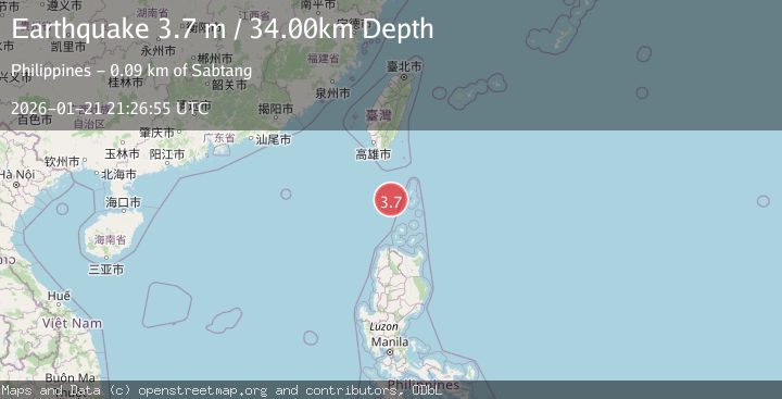
A 3.7 magnitude earthquake struck on BATAN ISL REGION, PHILIPPINES, at Wed, 21 Jan 2026 21:26:55 GMT. Depth: 34km. Reviewed by PIVS seismologists, this minor quake occurred at a magnitude type of m.
Magnitude
3.7
m
Source
PIVS
Intensity
-
Agency Reports
1 Sources| Source | Magnitude | Depth | Time |
|---|---|---|---|
| PIVSPrimary | 3.7 | 34 km | 0 months ago |
Earthquake Details
AutomaticEvent IDemsc_PIVS_20260121_0000422
Tsunami PotentialNo
Magnitude Typem
Nearest Places
- Chacaracarangen Point77.0 km
- Vuyavoy Point77.3 km
- Dequey Island77.8 km
- Ibahos Channel78.9 km
- Mauyen Landing79.5 km
Comments
Join the discussion about this event.
Latest Earthquakes
0.7Mag
7 km WNW of Cobb, CA
Time5 minutes ago
Depth1.75 km
SourceUSGS (Automatic)
1.2Mag
9 km N of Banning, CA
Time7 minutes ago
Depth18.03 km
SourceUSGS (Automatic)
2.1Mag
Southern California
Time8 minutes ago
Depth8.54 km
SourceVYT (Automatic)
2.2Mag
Sweden
Time12 minutes ago
Depth0.00 km
SourceVYT (Automatic)
2.6Mag
West Papua Region, Indonesia
Time15 minutes ago
Depth14.47 km
SourceBMKG
Nearby Earthquakes
3.0Mag
BATAN ISL REGION, PHILIPPINES
Time2 weeks ago
Depth28.00 km
SourcePIVS (Automatic)
5.2Mag
BATAN ISL REGION, PHILIPPINES
Time18 years ago
Depth10.00 km
SourceEMSC (Automatic)
5.0Mag
PHILIPPINE ISLANDS REGION
Time14 years ago
Depth30.00 km
SourceEMSC (Automatic)
5.0Mag
PHILIPPINE ISLANDS REGION
Time18 years ago
Depth24.00 km
SourceEMSC (Automatic)
3.0Mag
BATAN ISL REGION, PHILIPPINES
Time4 years ago
Depth11.00 km
SourcePIVS (Automatic)