Earthquake MORO GULF, MINDANAO, PHILIPPINES
Wed, 28 Jan 2026 15:35:29 GMT
Time4 hours ago
Location
6.6200, 123.6300
Depth
7.0 KM
Event Summary
A 3.1 magnitude earthquake struck on MORO GULF, MINDANAO, PHILIPPINES, at Wed, 28 Jan 2026 15:35:29 GMT. Depth: 7km. Reviewed by PIVS seismologists, this minor quake occurred at a magnitude type of m.
Magnitude
3.1
m
Source
PIVS
Intensity
-
Agency Reports
1 Sources| Source | Magnitude | Depth | Time |
|---|---|---|---|
| PIVSPrimary | 3.1 | 7 km | 4 hours ago |
Earthquake Details
AutomaticEvent IDemsc_PIVS_20260128_0000299
Tsunami PotentialNo
Magnitude Typem
Nearest Places
- Huidobro Reef37.9 km
- Donaung Shoals40.7 km
- Ipil Point41.0 km
- Linao Point41.2 km
- Salpa Point41.6 km
Comments
Join the discussion about this event.
Latest Earthquakes
4.2Mag
HOKKAIDO, JAPAN REGION
Time4 hours ago
Depth0.00 km
SourceJMA (Automatic)
2.9Mag
Java, Indonesia
Time4 hours ago
Depth5.00 km
SourceBMKG (Automatic)
1.1Mag
82 km NNW of Karluk, Alaska
Time4 hours ago
Depth5.00 km
SourceUSGS (Automatic)
3.3Mag
OFF W. COAST OF S. ISLAND, N.Z.
Time4 hours ago
Depth5.00 km
SourceGNS (Automatic)
0.8Mag
WESTERN TURKEY
Time4 hours ago
Depth7.00 km
SourceAFAD (Automatic)
Nearby Earthquakes
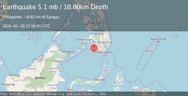
5.1Mag
MORO GULF, MINDANAO, PHILIPPINES
Time11 hours ago
Depth1.00 km
SourcePIVS (Automatic)
4.4Mag
MORO GULF, MINDANAO, PHILIPPINES
Time9 hours ago
Depth4.00 km
SourcePIVS (Automatic)
3.1Mag
MORO GULF, MINDANAO, PHILIPPINES
Time4 days ago
Depth19.00 km
SourcePIVS (Automatic)
4.6Mag
MORO GULF, MINDANAO, PHILIPPINES
Time6 hours ago
Depth6.00 km
SourcePIVS (Automatic)
3.0Mag
MORO GULF, MINDANAO, PHILIPPINES
Time6 days ago
Depth6.00 km
SourcePIVS (Automatic)