Earthquake MORO GULF, MINDANAO, PHILIPPINES
Wed, 28 Jan 2026 13:24:02 GMT
Time1 hour ago
Location
6.5500, 123.7100
Depth
6.0 KM
Event Summary
A 3.3 magnitude earthquake struck on MORO GULF, MINDANAO, PHILIPPINES, at Wed, 28 Jan 2026 13:24:02 GMT. Depth: 6km. Reviewed by PIVS seismologists, this minor quake occurred at a magnitude type of m.
Magnitude
3.3
m
Source
PIVS
Intensity
-
Agency Reports
1 Sources| Source | Magnitude | Depth | Time |
|---|---|---|---|
| PIVSPrimary | 3.3 | 6 km | 1 hour ago |
Earthquake Details
AutomaticEvent IDemsc_PIVS_20260128_0000246
Tsunami PotentialNo
Magnitude Typem
Nearest Places
- Donaung Shoals30.6 km
- Nara Point34.4 km
- Huidobro Reef34.5 km
- Pidtaguinan Point34.8 km
- Point Pitas35.2 km
Comments
Join the discussion about this event.
Latest Earthquakes
2.3Mag
34 km NW of Beluga, Alaska
Time1 hour ago
Depth83.70 km
SourceUSGS (Automatic)
3.4Mag
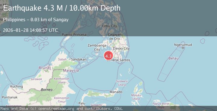
NEGROS- CEBU REG, PHILIPPINES
Time1 hour ago
Depth10.00 km
SourcePIVS (Automatic)
2.8Mag
Northern Molucca Sea
Time1 hour ago
Depth6.77 km
SourceBMKG (Automatic)
3.1Mag
Timor Region
Time1 hour ago
Depth6.99 km
SourceBMKG (Automatic)
2.5Mag
OKLAHOMA
Time1 hour ago
Depth1.10 km
SourceOK (Automatic)
Nearby Earthquakes
3.0Mag
MORO GULF, MINDANAO, PHILIPPINES
Time5 days ago
Depth6.00 km
SourcePIVS (Automatic)
3.2Mag
MORO GULF, MINDANAO, PHILIPPINES
Time3 hours ago
Depth10.00 km
SourcePIVS (Automatic)
4.4Mag
MORO GULF, MINDANAO, PHILIPPINES
Time5 hours ago
Depth4.00 km
SourcePIVS (Automatic)
3.2Mag
MORO GULF, MINDANAO, PHILIPPINES
Time2 days ago
Depth3.00 km
SourcePIVS (Automatic)
3.0Mag
MORO GULF, MINDANAO, PHILIPPINES
Time3 days ago
Depth9.00 km
SourcePIVS (Automatic)