Earthquake SOUTHERN CALIFORNIA
Sat, 31 Jan 2026 15:51:56 GMT
Time3 hours ago
Location
32.8028, -116.6457
Depth
17.2 KM
Event Summary
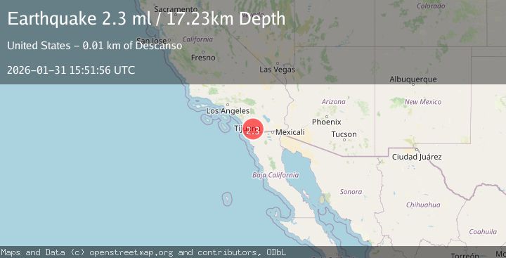
A 2.3 magnitude earthquake struck on SOUTHERN CALIFORNIA, at Sat, 31 Jan 2026 15:51:56 GMT. Depth: 17.2km. Reviewed by SCSN seismologists, this minor quake occurred at a magnitude type of ml.
Magnitude
2.3
ml
Source
SCSN
Intensity
-
Agency Reports
1 Sources| Source | Magnitude | Depth | Time |
|---|---|---|---|
| SCSNPrimary | 2.3 | 17 km | 3 hours ago |
Earthquake Details
AutomaticEvent IDemsc_SCSN_20260131_0000257
Tsunami PotentialNo
Magnitude Typeml
Nearest Places
- Laguna-Pine Valley0.2 km
- Ajax Prospect0.3 km
- Carl Spring1.9 km
- Horsethief Ridge Trail2.0 km
- Horsethief Ridge2.5 km
Comments
Join the discussion about this event.
Latest Earthquakes
3.4Mag
SALTA, ARGENTINA
Time3 hours ago
Depth207.00 km
SourceNSNA (Automatic)
2.1Mag
Northern Sumatra, Indonesia
Time3 hours ago
Depth22.75 km
SourceBMKG (Automatic)
2.3Mag
Bali Sea
Time3 hours ago
Depth18.72 km
SourceBMKG (Automatic)
1.7Mag
CENTRAL TURKEY
Time3 hours ago
Depth15.80 km
SourceAFAD (Automatic)
1.8Mag
21 km S of Denali National Park, Alaska
Time4 hours ago
Depth5.00 km
SourceUSGS (Automatic)
Nearby Earthquakes
1.5Mag
11 km W of Pine Valley, CA
Time1 week ago
Depth17.33 km
SourceUSGS (Automatic)
1.6Mag
11 km W of Pine Valley, CA
Time3 days ago
Depth16.83 km
SourceUSGS (Automatic)
1.7Mag
11 km W of Pine Valley, CA
Time1 week ago
Depth16.60 km
SourceUSGS (Automatic)
1.9Mag
10 km W of Pine Valley, CA
Time3 days ago
Depth17.28 km
SourceUSGS (Automatic)
1.3Mag
10 km W of Pine Valley, CA
Time1 week ago
Depth18.73 km
SourceUSGS (Automatic)