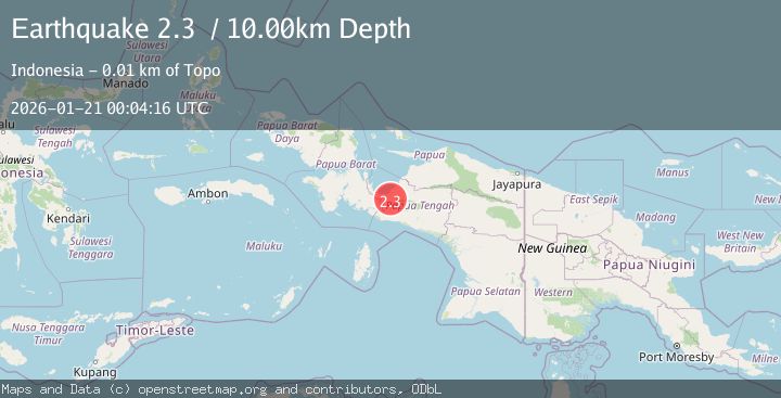
Earthquake West Papua Region, Indonesia
Wed, 21 Jan 2026 00:04:16 GMT
Time6 days ago
Location
-3.5600, 135.5800
Depth
10.0 KM
Event Summary
A 2.3 magnitude earthquake struck on West Papua Region, Indonesia, at Wed, 21 Jan 2026 00:04:16 GMT. Depth: 10km. Reviewed by BMKG seismologists, this minor quake occurred at a magnitude type of .
Magnitude
2.3
Source
BMKG
Intensity
-
Agency Reports
1 Sources| Source | Magnitude | Depth | Time |
|---|---|---|---|
| BMKGPrimary | 2.3 | 10 km | 6 days ago |
Earthquake Details
AutomaticEvent IDrs_BMKG_rs2026bksrhg
Tsunami PotentialNo
Magnitude Type
Nearest Places
- Kabupaten Nabire3.5 km
- Distrik Uwapa4.5 km
- Topo5.2 km
- Kampung Gamei Jaya6.3 km
- Kampung Argo Mulyo6.7 km
Comments
Join the discussion about this event.
Latest Earthquakes
2.1Mag
Near North Coast of West Papua
Time4 minutes ago
Depth10.00 km
SourceBMKG (Automatic)
1.6Mag
4 km SE of Julian, CA
Time20 minutes ago
Depth10.57 km
SourceUSGS (Automatic)
3.4Mag
BIO-BIO, CHILE
Time22 minutes ago
Depth17.50 km
SourceCSN (Automatic)
2.7Mag
FRANCE
Time28 minutes ago
Depth5.00 km
SourceReNaSS (Automatic)
3.0Mag
South of Bali, Indonesia
Time29 minutes ago
Depth21.74 km
SourceBMKG (Automatic)
Nearby Earthquakes
3.4Mag
West Papua Region, Indonesia
Time2 hours ago
Depth26.26 km
SourceBMKG (Automatic)
3.2Mag
West Papua Region, Indonesia
Time6 days ago
Depth10.00 km
SourceBMKG (Automatic)
2.0Mag
West Papua Region, Indonesia
Time1 day ago
Depth10.00 km
SourceBMKG (Automatic)
2.4Mag
West Papua Region, Indonesia
Time5 days ago
Depth7.00 km
SourceBMKG (Automatic)
2.4Mag
West Papua Region, Indonesia
Time3 days ago
Depth14.61 km
SourceBMKG (Automatic)