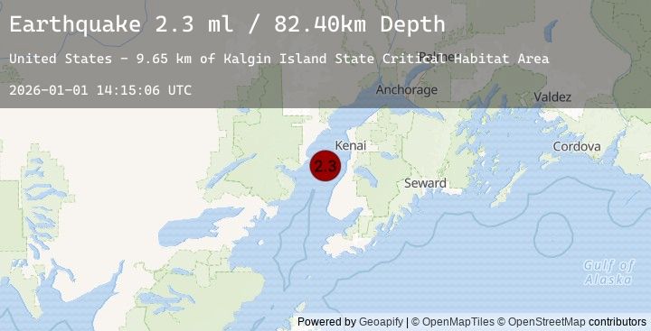
Earthquake 27 km WNW of Clam Gulch, Alaska
Thu, 01 Jan 2026 14:15:06 GMT
Time3 hours ago
Location
60.3100, -151.8680
Depth
82.4 KM
Event Summary
A 2.3 magnitude earthquake struck on 27 km WNW of Clam Gulch, Alaska, at Thu, 01 Jan 2026 14:15:06 GMT. Depth: 82.4km. Reviewed by USGS seismologists, this minor quake occurred at a magnitude type of ml.
Magnitude
2.3
ml
Source
USGS
Intensity
-
Earthquake Details
AutomaticEvent IDusgs_ak2026abciwo
Tsunami PotentialNo
Magnitude Typeml
Nearest Places
- Kalgin Island State Critical Habitat Area9.6 km
- Swamp Creek11.4 km
- Oldmans Bay11.5 km
- Packers Creek14.5 km
- Kalgin Island17.6 km
Comments
Join the discussion about this event.
Latest Earthquakes
2.5Mag
48 km W of Karluk, Alaska
Time3 hours ago
Depth68.20 km
SourceUSGS (Automatic)
2.4Mag
50 km W of Karluk, Alaska
Time3 hours ago
Depth70.60 km
SourceUSGS (Automatic)
2.5Mag
CENTRAL TURKEY
Time3 hours ago
Depth4.40 km
SourceEMSC (Automatic)
4.4Mag
MYANMAR
Time3 hours ago
Depth10.00 km
SourceEMSC (Automatic)
2.4Mag
Sulawesi, Indonesia
Time3 hours ago
Depth5.00 km
SourceBMKG (Automatic)
Nearby Earthquakes
2.2Mag
24 km SW of Anchor Point, Alaska
Time4 hours ago
Depth62.20 km
SourceUSGS (Automatic)
2.1Mag
60 km ENE of Pedro Bay, Alaska
Time7 hours ago
Depth127.30 km
SourceUSGS (Automatic)
1.9Mag
43 km WSW of Anchor Point, Alaska
Time16 hours ago
Depth71.10 km
SourceUSGS (Automatic)
4.0Mag
SOUTHERN ALASKA
Time20 hours ago
Depth101.20 km
SourceEMSC (Automatic)
3.7Mag
62 km W of Happy Valley, Alaska
Time20 hours ago
Depth116.10 km
SourceUSGS (Automatic)