Earthquake 74 km ESE of Ugashik, Alaska
Fri, 02 Jan 2026 08:59:07 GMT
Time4 hours ago
Location
57.2860, -156.2380
Depth
73.9 KM
Event Summary
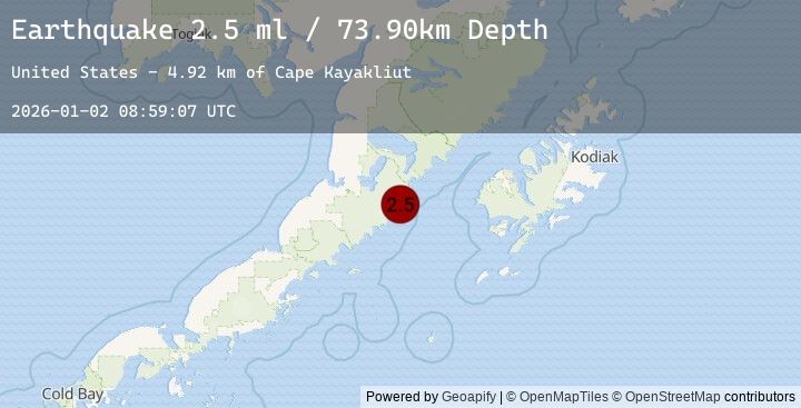
A 2.5 magnitude earthquake struck on 74 km ESE of Ugashik, Alaska, at Fri, 02 Jan 2026 08:59:07 GMT. Depth: 73.9km. Reviewed by USGS seismologists, this minor quake occurred at a magnitude type of ml.
Magnitude
2.5
ml
Source
USGS
Intensity
-
Agency Reports
1 Sources| Source | Magnitude | Depth | Time |
|---|---|---|---|
| USGSPrimary | 2.5 | 74 km | 4 hours ago |
Earthquake Details
AutomaticEvent IDusgs_ak2026acnplt
Tsunami PotentialNo
Magnitude Typeml
Nearest Places
- Cape Kayakliut4.9 km
- Slaughter Island (not official)7.4 km
- Titcliff Island7.5 km
- Imuya Bay9.3 km
- Hartman Island9.5 km
Comments
Join the discussion about this event.
Latest Earthquakes
2.4Mag
Sulawesi, Indonesia
Time4 hours ago
Depth2.61 km
SourceBMKG (Automatic)
2.9Mag
44 km NW of Ninilchik, Alaska
Time4 hours ago
Depth83.80 km
SourceUSGS (Automatic)
1.5Mag
35 km SSE of Mina, Nevada
Time4 hours ago
Depth0.05 km
SourceUSGS (Automatic)
1.8Mag
WESTERN TURKEY
Time4 hours ago
Depth7.00 km
SourceAFAD (Automatic)
1.5Mag
51 km WNW of Toyah, Texas
Time4 hours ago
Depth0.00 km
SourceUSGS (Automatic)
Nearby Earthquakes
2.5Mag
61 km E of Egegik, Alaska
Time10 hours ago
Depth17.10 km
SourceUSGS (Automatic)
1.6Mag
72 km W of Karluk, Alaska
Time17 hours ago
Depth17.20 km
SourceUSGS (Automatic)
2.5Mag
48 km W of Karluk, Alaska
Time23 hours ago
Depth68.20 km
SourceUSGS (Automatic)
2.4Mag
50 km W of Karluk, Alaska
Time23 hours ago
Depth70.60 km
SourceUSGS (Automatic)
2.0Mag
68 km WNW of Karluk, Alaska
Time1 day ago
Depth84.90 km
SourceUSGS (Automatic)