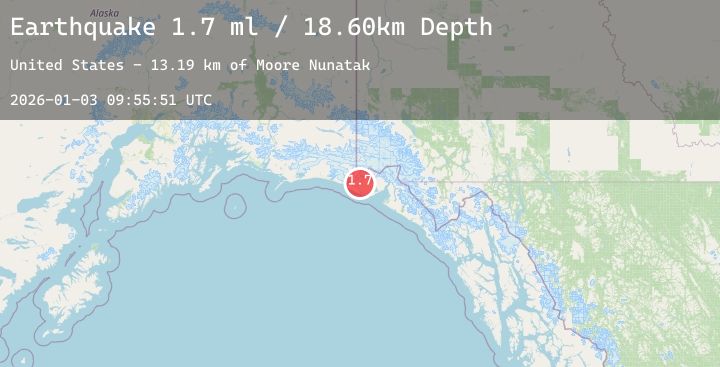
Earthquake 77 km NW of Yakutat, Alaska
Sat, 03 Jan 2026 09:55:51 GMT
Time5 days ago
Location
59.9700, -140.8290
Depth
18.6 KM
Event Summary
A 1.7 magnitude earthquake struck on 77 km NW of Yakutat, Alaska, at Sat, 03 Jan 2026 09:55:51 GMT. Depth: 18.6km. Reviewed by USGS seismologists, this minor quake occurred at a magnitude type of ml.
Magnitude
1.7
ml
Source
USGS
Intensity
-
Agency Reports
1 Sources| Source | Magnitude | Depth | Time |
|---|---|---|---|
| USGSPrimary | 1.7 | 19 km | 5 days ago |
Earthquake Details
AutomaticEvent IDusgs_ak2026aelffi
Tsunami PotentialNo
Magnitude Typeml
Nearest Places
- Moore Nunatak13.2 km
- Malaspina Glacier15.7 km
- Crater Lake16.3 km
- Chaix Hills18.4 km
- Oily Lake19.0 km
Comments
Join the discussion about this event.
Latest Earthquakes
2.4Mag
South of Sumbawa, Indonesia
Time4 days ago
Depth10.00 km
SourceBMKG (Automatic)
2.0Mag
Sumbawa Region, Indonesia
Time4 days ago
Depth24.01 km
SourceBMKG (Automatic)
4.2Mag
GUERRERO, MEXICO
Time4 days ago
Depth10.80 km
SourceUNM (Automatic)
3.5Mag
MINDORO, PHILIPPINES
Time4 days ago
Depth10.00 km
SourcePIVS (Automatic)
1.0Mag
40 km SSW of South Van Horn, Alaska
Time4 days ago
Depth13.90 km
SourceUSGS (Automatic)