Earthquake 88 km N of Yakutat, Alaska
Sat, 03 Jan 2026 00:16:13 GMT
Time4 hours ago
Location
60.3360, -139.9050
Depth
5.0 KM
Event Summary
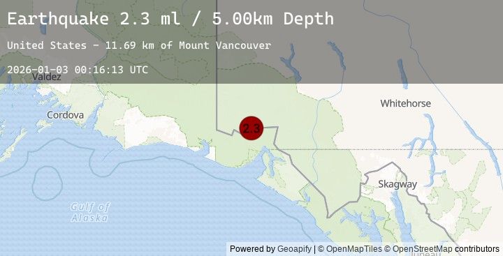
A 2.3 magnitude earthquake struck on 88 km N of Yakutat, Alaska, at Sat, 03 Jan 2026 00:16:13 GMT. Depth: 5km. Reviewed by USGS seismologists, this minor quake occurred at a magnitude type of ml.
Magnitude
2.3
ml
Source
USGS
Intensity
-
Agency Reports
1 Sources| Source | Magnitude | Depth | Time |
|---|---|---|---|
| USGSPrimary | 2.3 | 5 km | 4 hours ago |
Earthquake Details
AutomaticEvent IDusgs_ak2026adrztg
Tsunami PotentialNo
Magnitude Typeml
Nearest Places
- Mount Vancouver11.7 km
- Saint Elias Mountains15.2 km
- Mount Cook17.6 km
- Mount Cook17.7 km
- Marker Lake20.1 km
Comments
Join the discussion about this event.
Latest Earthquakes
3.8Mag
NEAR COAST OF NORTHERN PERU
Time4 hours ago
Depth43.00 km
SourceLIM (Automatic)
2.0Mag
WESTERN TURKEY
Time4 hours ago
Depth2.40 km
SourceKOERI (Automatic)
3.8Mag
SALTA, ARGENTINA
Time4 hours ago
Depth177.00 km
SourceCSN (Automatic)
2.7Mag
West Papua Region, Indonesia
Time4 hours ago
Depth15.47 km
SourceBMKG (Automatic)
1.8Mag
WESTERN TURKEY
Time4 hours ago
Depth9.70 km
SourceEMSC (Automatic)
Nearby Earthquakes
3.0Mag
SOUTHEASTERN ALASKA
Time8 hours ago
Depth0.30 km
SourceAK (Automatic)
3.1Mag
SOUTHERN YUKON TERRITORY, CANADA
Time20 hours ago
Depth5.00 km
SourceNEIC (Automatic)
1.9Mag
93 km WNW of Yakutat, Alaska
Time23 hours ago
Depth4.70 km
SourceUSGS (Automatic)
3.7Mag
104 km N of Yakutat, Alaska
Time1 day ago
Depth10.20 km
SourceUSGS
2.0Mag
98 km N of Yakutat, Alaska
Time1 day ago
Depth0.00 km
SourceUSGS