Earthquake 66 km ESE of Egegik, Alaska
Sat, 03 Jan 2026 12:26:06 GMT
Time3 days ago
Location
57.9180, -156.3900
Depth
126.5 KM
Event Summary
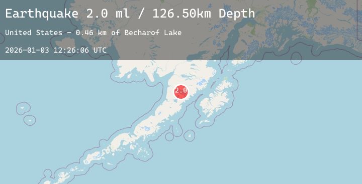
A 2.0 magnitude earthquake struck on 66 km ESE of Egegik, Alaska, at Sat, 03 Jan 2026 12:26:06 GMT. Depth: 126.5km. Reviewed by USGS seismologists, this minor quake occurred at a magnitude type of ml.
Magnitude
2.0
ml
Source
USGS
Intensity
-
Agency Reports
1 Sources| Source | Magnitude | Depth | Time |
|---|---|---|---|
| USGSPrimary | 2.0 | 127 km | 3 days ago |
Earthquake Details
AutomaticEvent IDusgs_ak2026aeqeiq
Tsunami PotentialNo
Magnitude Typeml
Nearest Places
- Becharof Lake0.5 km
- The Gas Rocks9.2 km
- Ukinrek Maars12.2 km
- Whale Mountain14.4 km
- Becharof National Wildlife Refuge14.8 km
Comments
Join the discussion about this event.
Latest Earthquakes
3.4Mag
Northern Sumatra, Indonesia
Time3 days ago
Depth40.13 km
SourceBMKG (Automatic)
1.1Mag
26 km ENE of McKinney Acres, Texas
Time3 days ago
Depth3.84 km
SourceUSGS (Automatic)
2.1Mag
FRANCE
Time3 days ago
Depth0.00 km
SourceReNaSS (Automatic)
2.0Mag
AEGEAN SEA
Time3 days ago
Depth2.70 km
SourceEMSC (Automatic)
1.3Mag
WESTERN TURKEY
Time3 days ago
Depth10.20 km
SourceAFAD (Automatic)
Nearby Earthquakes
2.0Mag
72 km W of Karluk, Alaska
Time3 days ago
Depth72.90 km
SourceUSGS (Automatic)
0.5Mag
84 km NNW of Karluk, Alaska
Time3 days ago
Depth2.80 km
SourceUSGS (Automatic)
1.4Mag
87 km W of Karluk, Alaska
Time4 days ago
Depth4.50 km
SourceUSGS (Automatic)
1.7Mag
75 km W of Karluk, Alaska
Time4 days ago
Depth72.60 km
SourceUSGS (Automatic)