Earthquake 84 km NNW of Karluk, Alaska
Wed, 07 Jan 2026 19:18:17 GMT
Time2 days ago
Location
58.2440, -155.0920
Depth
5.0 KM
Event Summary
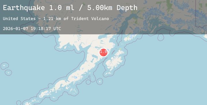
A 1.0 magnitude earthquake struck on 84 km NNW of Karluk, Alaska, at Wed, 07 Jan 2026 19:18:17 GMT. Depth: 5km. Reviewed by USGS seismologists, this minor quake occurred at a magnitude type of ml.
Magnitude
1.0
ml
Source
USGS
Intensity
-
Agency Reports
1 Sources| Source | Magnitude | Depth | Time |
|---|---|---|---|
| USGSPrimary | 1.0 | 5 km | 2 days ago |
Earthquake Details
AutomaticEvent IDusgs_ak2026ammtkn
Tsunami PotentialNo
Magnitude Typeml
Nearest Places
- Trident Volcano1.2 km
- The Knife Creek Glacier4.3 km
- Novarupta4.5 km
- Falling Mountain5.0 km
- Katmai Pass5.1 km
Comments
Join the discussion about this event.
Latest Earthquakes
2.6Mag
West Papua Region, Indonesia
Time1 day ago
Depth31.00 km
SourceBMKG (Automatic)
4.1Mag
KEPULAUAN ARU REGION, INDONESIA
Time1 day ago
Depth88.00 km
SourceBMKG (Automatic)
2.9Mag
ASSAM, INDIA
Time1 day ago
Depth10.00 km
SourceNDI (Automatic)
3.2Mag
Northern Sumatra, Indonesia
Time1 day ago
Depth3.94 km
SourceBMKG (Automatic)
2.6Mag
33 km W of Anchor Point, Alaska
Time1 day ago
Depth75.60 km
SourceUSGS (Automatic)
Nearby Earthquakes
2.6Mag
56 km E of Egegik, Alaska
Time1 day ago
Depth5.00 km
SourceUSGS (Automatic)
1.2Mag
84 km NNW of Karluk, Alaska
Time1 day ago
Depth5.00 km
SourceUSGS (Automatic)
0.7Mag
87 km NNW of Karluk, Alaska
Time1 day ago
Depth5.00 km
SourceUSGS (Automatic)
2.4Mag
30 km WNW of Karluk, Alaska
Time2 days ago
Depth68.80 km
SourceUSGS (Automatic)