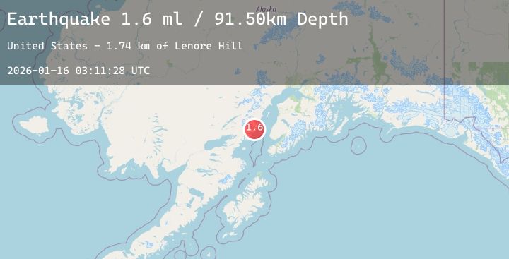
Earthquake 57 km WNW of Anchor Point, Alaska
Fri, 16 Jan 2026 03:11:28 GMT
Time2 hours ago
Location
59.9640, -152.7900
Depth
91.5 KM
Event Summary
A 2.1 magnitude earthquake struck on 57 km WNW of Anchor Point, Alaska, at Fri, 16 Jan 2026 03:11:28 GMT. Depth: 91.5km. Reviewed by USGS seismologists, this minor quake occurred at a magnitude type of ml.
Magnitude
2.1
ml
Source
USGS
Intensity
-
Agency Reports
1 Sources| Source | Magnitude | Depth | Time |
|---|---|---|---|
| USGSPrimary | 2.1 | 92 km | 2 hours ago |
Earthquake Details
AutomaticEvent IDusgs_ak2026bbughf
Tsunami PotentialNo
Magnitude Typeml
Nearest Places
- Lenore Hill1.7 km
- Saddle Mountain4.1 km
- Blue Lake5.9 km
- Red River7.0 km
- Triangle Peak7.4 km
Comments
Join the discussion about this event.
Latest Earthquakes
2.8Mag
Sumbawa Region, Indonesia
Time4 minutes ago
Depth10.00 km
SourceBMKG (Automatic)
2.5Mag
Minahassa Peninsula, Sulawesi
Time10 minutes ago
Depth5.00 km
SourceBMKG (Automatic)
0.5Mag
9 km NNW of Idyllwild, CA
Time15 minutes ago
Depth9.94 km
SourceUSGS (Automatic)
2.3Mag
PUERTO RICO REGION
Time18 minutes ago
Depth14.30 km
SourcePR (Automatic)
3.3Mag
NEW MEXICO
Time19 minutes ago
Depth10.00 km
SourceNEIC (Automatic)
Nearby Earthquakes
2.3Mag
40 km W of Anchor Point, Alaska
Time3 hours ago
Depth88.40 km
SourceUSGS (Automatic)
1.6Mag
52 km WNW of Ninilchik, Alaska
Time9 hours ago
Depth102.90 km
SourceUSGS (Automatic)
2.3Mag
32 km W of Happy Valley, Alaska
Time12 hours ago
Depth72.80 km
SourceUSGS (Automatic)
2.3Mag
57 km WNW of Happy Valley, Alaska
Time14 hours ago
Depth121.80 km
SourceUSGS (Automatic)
2.6Mag
50 km ENE of Pedro Bay, Alaska
Time18 hours ago
Depth147.90 km
SourceUSGS (Automatic)