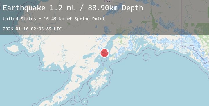
Earthquake 40 km W of Anchor Point, Alaska
Fri, 16 Jan 2026 02:03:59 GMT
Time1 hour ago
Location
59.7770, -152.5570
Depth
88.4 KM
Event Summary
A 2.3 magnitude earthquake struck on 40 km W of Anchor Point, Alaska, at Fri, 16 Jan 2026 02:03:59 GMT. Depth: 88.4km. Reviewed by USGS seismologists, this minor quake occurred at a magnitude type of ml.
Magnitude
2.3
ml
Source
USGS
Intensity
-
Agency Reports
1 Sources| Source | Magnitude | Depth | Time |
|---|---|---|---|
| USGSPrimary | 2.3 | 88 km | 1 hour ago |
Earthquake Details
AutomaticEvent IDusgs_ak2026bbsacn
Tsunami PotentialNo
Magnitude Typeml
Nearest Places
- Red River17.7 km
- Spring Point18.0 km
- Shelter Cove18.3 km
- Herbs Lagoon18.5 km
- Shelter Creek19.1 km
Comments
Join the discussion about this event.
Latest Earthquakes
2.1Mag
Sumbawa Region, Indonesia
Time5 minutes ago
Depth49.05 km
SourceBMKG (Automatic)
2.9Mag
Java, Indonesia
Time6 minutes ago
Depth19.62 km
SourceBMKG (Automatic)
2.3Mag
Sumbawa Region, Indonesia
Time10 minutes ago
Depth22.63 km
SourceBMKG (Automatic)
0.7Mag
3 km NW of The Geysers, CA
Time13 minutes ago
Depth1.14 km
SourceUSGS (Automatic)
2.6Mag
NEAR COAST OF NICARAGUA
Time16 minutes ago
Depth29.00 km
SourceINET (Automatic)
Nearby Earthquakes
2.1Mag
57 km WNW of Anchor Point, Alaska
Time35 minutes ago
Depth91.50 km
SourceUSGS (Automatic)
1.6Mag
52 km WNW of Ninilchik, Alaska
Time7 hours ago
Depth102.90 km
SourceUSGS (Automatic)
2.3Mag
32 km W of Happy Valley, Alaska
Time11 hours ago
Depth72.80 km
SourceUSGS (Automatic)
2.3Mag
57 km WNW of Happy Valley, Alaska
Time13 hours ago
Depth121.80 km
SourceUSGS (Automatic)
2.6Mag
50 km ENE of Pedro Bay, Alaska
Time16 hours ago
Depth147.90 km
SourceUSGS (Automatic)