Earthquake 3 km SE of Point MacKenzie, Alaska
Sat, 17 Jan 2026 02:50:06 GMT
Time2 hours ago
Location
61.3340, -149.9290
Depth
19.5 KM
Event Summary
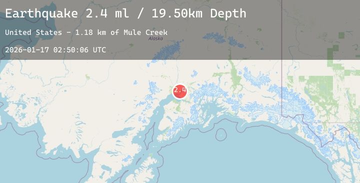
A 2.4 magnitude earthquake struck on 3 km SE of Point MacKenzie, Alaska, at Sat, 17 Jan 2026 02:50:06 GMT. Depth: 19.5km. Reviewed by USGS seismologists, this minor quake occurred at a magnitude type of ml.
Magnitude
2.4
ml
Source
USGS
Intensity
-
Agency Reports
1 Sources| Source | Magnitude | Depth | Time |
|---|---|---|---|
| USGSPrimary | 2.4 | 20 km | 2 hours ago |
Earthquake Details
AutomaticEvent IDusgs_ak2026bdpgre
Tsunami PotentialNo
Magnitude Typeml
Nearest Places
- Mule Creek1.2 km
- Lost Lake3.6 km
- Point MacKenzie3.9 km
- Lost Lake Seaplane Base4.0 km
- Elmendorf Moraine4.0 km
Comments
Join the discussion about this event.
Latest Earthquakes
2.4Mag
Sulawesi, Indonesia
Time2 hours ago
Depth2.76 km
SourceBMKG (Automatic)
1.9Mag
2 km SSW of Indios, Puerto Rico
Time2 hours ago
Depth15.91 km
SourceUSGS
2.1Mag
SPAIN
Time2 hours ago
Depth0.00 km
SourceIGN (Automatic)
2.2Mag
49 km W of Anchor Point, Alaska
Time2 hours ago
Depth89.50 km
SourceUSGS (Automatic)
1.2Mag
CENTRAL TURKEY
Time2 hours ago
Depth7.00 km
SourceAFAD (Automatic)