Earthquake 47 km E of Cordova, Alaska
Wed, 21 Jan 2026 09:15:58 GMT
Time6 days ago
Location
60.4960, -144.9080
Depth
16.9 KM
Event Summary
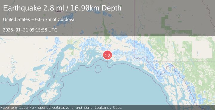
A 2.8 magnitude earthquake struck on 47 km E of Cordova, Alaska, at Wed, 21 Jan 2026 09:15:58 GMT. Depth: 16.9km. Reviewed by USGS seismologists, this minor quake occurred at a magnitude type of ml.
Magnitude
2.8
ml
Source
USGS
Intensity
-
Agency Reports
1 Sources| Source | Magnitude | Depth | Time |
|---|---|---|---|
| USGSPrimary | 2.8 | 17 km | 6 days ago |
Earthquake Details
AutomaticEvent IDusgs_ak2026blkysb
Tsunami PotentialNo
Magnitude Typeml
Nearest Places
- Hotcake Channel1.1 km
- Long Island3.7 km
- Copper River Delta4.9 km
- Heart Island5.9 km
- Sheep Creek7.0 km
Comments
Join the discussion about this event.
Latest Earthquakes
2.6Mag
Minahassa Peninsula, Sulawesi
Time18 hours ago
Depth118.00 km
SourceBMKG (Automatic)
2.8Mag
South of Bali, Indonesia
Time18 hours ago
Depth10.00 km
SourceBMKG (Automatic)
1.7Mag
31 km SE of Denali National Park, Alaska
Time18 hours ago
Depth0.60 km
SourceUSGS (Automatic)
2.2Mag
WESTERN TURKEY
Time18 hours ago
Depth14.90 km
SourceKOERI (Automatic)
2.2Mag
13 km NW of Ferry, Alaska
Time18 hours ago
Depth139.50 km
SourceUSGS (Automatic)
Nearby Earthquakes
2.8Mag
40 km ESE of Cordova, Alaska
Time5 days ago
Depth27.10 km
SourceUSGS (Automatic)
1.1Mag
112 km E of Cordova, Alaska
Time4 days ago
Depth13.00 km
SourceUSGS (Automatic)
1.1Mag
86 km SSW of McCarthy, Alaska
Time1 day ago
Depth5.00 km
SourceUSGS (Automatic)
1.2Mag
19 km S of Tatitlek, Alaska
Time2 days ago
Depth26.20 km
SourceUSGS (Automatic)
1.8Mag
113 km S of McCarthy, Alaska
Time23 hours ago
Depth12.10 km
SourceUSGS (Automatic)