Earthquake 56 km NE of Chenega, Alaska
Thu, 22 Jan 2026 10:43:26 GMT
Time5 days ago
Location
60.4660, -147.3920
Depth
20.9 KM
Event Summary
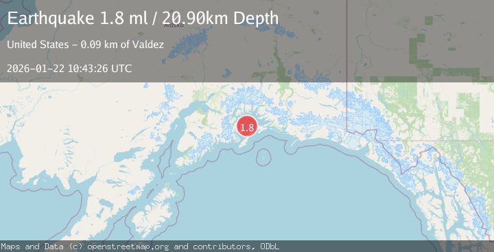
A 1.8 magnitude earthquake struck on 56 km NE of Chenega, Alaska, at Thu, 22 Jan 2026 10:43:26 GMT. Depth: 20.9km. Reviewed by USGS seismologists, this minor quake occurred at a magnitude type of ml.
Magnitude
1.8
ml
Source
USGS
Intensity
-
Agency Reports
1 Sources| Source | Magnitude | Depth | Time |
|---|---|---|---|
| USGSPrimary | 1.8 | 21 km | 5 days ago |
Earthquake Details
AutomaticEvent IDusgs_ak2026bnjoyn
Tsunami PotentialNo
Magnitude Typeml
Nearest Places
- Pennsylvania Rock Buoy2.5 km
- Pennsylvania Rock2.5 km
- Seal Island Light4.3 km
- Seal Island4.5 km
- Little Smith Island6.1 km
Comments
Join the discussion about this event.
Latest Earthquakes
1.4Mag
41 km NW of Toyah, Texas
Time7 minutes ago
Depth2.74 km
SourceUSGS (Automatic)
2.0Mag
Sumbawa Region, Indonesia
Time11 minutes ago
Depth107.77 km
SourceBMKG (Automatic)
1.7Mag
26 km WNW of Ludlow, CA
Time15 minutes ago
Depth1.36 km
SourceUSGS (Automatic)
3.1Mag
HAITI REGION
Time18 minutes ago
Depth7.00 km
SourceAYIT (Automatic)
2.6Mag
PUERTO RICO
Time24 minutes ago
Depth16.10 km
SourcePR (Automatic)
Nearby Earthquakes
2.2Mag
52 km NNE of Chenega, Alaska
Time8 hours ago
Depth27.90 km
SourceUSGS (Automatic)
3.0Mag
SOUTHERN ALASKA
Time2 days ago
Depth19.90 km
SourceAK (Automatic)
1.5Mag
27 km NNE of Chenega, Alaska
Time3 days ago
Depth18.70 km
SourceUSGS (Automatic)
1.2Mag
19 km S of Tatitlek, Alaska
Time2 days ago
Depth26.20 km
SourceUSGS (Automatic)
1.6Mag
53 km W of Tatitlek, Alaska
Time2 days ago
Depth13.20 km
SourceUSGS (Automatic)