Earthquake 53 km W of Tatitlek, Alaska
Sun, 25 Jan 2026 01:08:02 GMT
Time2 days ago
Location
60.9150, -147.6660
Depth
13.2 KM
Event Summary
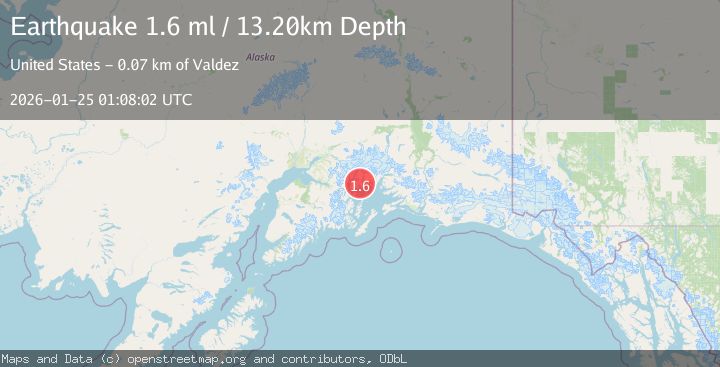
A 1.6 magnitude earthquake struck on 53 km W of Tatitlek, Alaska, at Sun, 25 Jan 2026 01:08:02 GMT. Depth: 13.2km. Reviewed by USGS seismologists, this minor quake occurred at a magnitude type of ml.
Magnitude
1.6
ml
Source
USGS
Intensity
-
Agency Reports
1 Sources| Source | Magnitude | Depth | Time |
|---|---|---|---|
| USGSPrimary | 1.6 | 13 km | 2 days ago |
Earthquake Details
AutomaticEvent IDusgs_ak2026bsdrtt
Tsunami PotentialNo
Magnitude Typeml
Nearest Places
- Schoppe Bay3.6 km
- Mueller Cove4.0 km
- Cascade Island4.5 km
- Siwash Bay4.5 km
- Siwash Island5.8 km
Comments
Join the discussion about this event.
Latest Earthquakes
3.7Mag
VALPARAISO, CHILE
Time1 hour ago
Depth27.60 km
SourceCSN (Automatic)
2.0Mag
CENTRAL TURKEY
Time1 hour ago
Depth23.50 km
SourceKOERI (Automatic)
3.2Mag
OFFSHORE EL SALVADOR
Time1 hour ago
Depth28.00 km
SourceINET (Automatic)
3.1Mag
South of Java, Indonesia
Time1 hour ago
Depth5.01 km
SourceBMKG (Automatic)
2.2Mag
Near North Coast of West Papua
Time1 hour ago
Depth10.00 km
SourceBMKG (Automatic)
Nearby Earthquakes
1.3Mag
47 km WNW of Tatitlek, Alaska
Time3 days ago
Depth5.00 km
SourceUSGS (Automatic)
1.5Mag
52 km WNW of Tatitlek, Alaska
Time4 days ago
Depth7.30 km
SourceUSGS (Automatic)
1.0Mag
61 km NE of Whittier, Alaska
Time4 days ago
Depth46.70 km
SourceUSGS (Automatic)
3.5Mag
45 km NW of Tatitlek, Alaska
Time4 hours ago
Depth13.60 km
SourceUSGS (Automatic)
3.2Mag
22 km WNW of Tatitlek, Alaska
Time4 days ago
Depth18.30 km
SourceUSGS (Automatic)