Earthquake 77 km NW of Eureka Roadhouse, Alaska
Fri, 06 Feb 2026 10:35:32 GMT
Time1 hour ago
Location
62.4750, -148.1060
Depth
44.2 KM
Event Summary
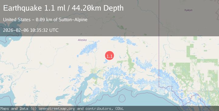
A 1.1 magnitude earthquake struck on 77 km NW of Eureka Roadhouse, Alaska, at Fri, 06 Feb 2026 10:35:32 GMT. Depth: 44.2km. Reviewed by USGS seismologists, this minor quake occurred at a magnitude type of ml.
Magnitude
1.1
ml
Source
USGS
Intensity
-
Agency Reports
1 Sources| Source | Magnitude | Depth | Time |
|---|---|---|---|
| USGSPrimary | 1.1 | 44 km | 1 hour ago |
Earthquake Details
AutomaticEvent IDusgs_ak2026coxfiz
Tsunami PotentialNo
Magnitude Typeml
Nearest Places
- George Creek6.3 km
- John Creek7.2 km
- Terrace Creek12.0 km
- Black Lake13.7 km
- Crater Lake20.3 km
Comments
Join the discussion about this event.
Latest Earthquakes
1.7Mag
37 km N of Glacier View, Alaska
Time3 minutes ago
Depth23.40 km
SourceUSGS (Automatic)
3.7Mag
South of Bali, Indonesia
Time4 minutes ago
Depth10.00 km
SourceBMKG (Automatic)
2.9Mag
West Papua Region, Indonesia
Time14 minutes ago
Depth15.50 km
SourceBMKG (Automatic)
2.6Mag
FRANCE
Time18 minutes ago
Depth5.00 km
SourceReNaSS (Automatic)
2.4Mag
West Papua Region, Indonesia
Time19 minutes ago
Depth10.00 km
SourceBMKG (Automatic)
Nearby Earthquakes
1.7Mag
57 km N of Chickaloon, Alaska
Time1 week ago
Depth51.00 km
SourceUSGS (Automatic)
1.4Mag
69 km ENE of Susitna North, Alaska
Time3 days ago
Depth40.30 km
SourceUSGS (Automatic)
1.8Mag
39 km N of Glacier View, Alaska
Time1 week ago
Depth36.20 km
SourceUSGS (Automatic)
2.0Mag
40 km NNW of Glacier View, Alaska
Time13 hours ago
Depth34.90 km
SourceUSGS
2.6Mag
38 km NNE of Chickaloon, Alaska
Time1 week ago
Depth20.00 km
SourceUSGS (Automatic)