Earthquake 99 km E of McCarthy, Alaska
Mon, 16 Feb 2026 04:49:26 GMT
Time2 days ago
Location
61.3730, -141.0630
Depth
0.5 KM
Event Summary
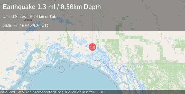
A 1.3 magnitude earthquake struck on 99 km E of McCarthy, Alaska, at Mon, 16 Feb 2026 04:49:26 GMT. Depth: 0.5km. Reviewed by USGS seismologists, this minor quake occurred at a magnitude type of ml.
Magnitude
1.3
ml
Source
USGS
Intensity
-
Agency Reports
1 Sources| Source | Magnitude | Depth | Time |
|---|---|---|---|
| USGSPrimary | 1.3 | 1 km | 2 days ago |
Earthquake Details
AutomaticEvent IDusgs_ak2026dguzxk
Tsunami PotentialNo
Magnitude Typeml
Nearest Places
- Crag Mountain7.9 km
- Mount Bear10.8 km
- Nesham Glacier11.2 km
- Ice Fall Peak12.7 km
- Klutlan Glacier14.5 km
Comments
Join the discussion about this event.
Latest Earthquakes
2.3Mag
Tarapaca, Chile
Time1 minute ago
Depth114.14 km
SourceVYT (Automatic)
2.1Mag
Southern Alaska
Time5 minutes ago
Depth67.26 km
SourceVYT (Automatic)
2.2Mag
western Russia
Time8 minutes ago
Depth0.00 km
SourceVYT (Automatic)
1.5Mag
4 km NNW of The Geysers, CA
Time9 minutes ago
Depth-0.27 km
SourceUSGS (Automatic)
1.0Mag
9 km WNW of Two Rivers, Alaska
Time9 minutes ago
Depth5.70 km
SourceUSGS (Automatic)
Nearby Earthquakes
1.5Mag
100 km E of McCarthy, Alaska
Time3 weeks ago
Depth5.00 km
SourceUSGS (Automatic)
1.7Mag
Southern Alaska
Time4 hours ago
Depth13.79 km
SourceVYT (Automatic)
1.2Mag
96 km E of McCarthy, Alaska
Time2 weeks ago
Depth5.00 km
SourceUSGS (Automatic)
3.1Mag
SOUTHERN ALASKA
Time2 weeks ago
Depth1.70 km
SourceAK (Automatic)
1.9Mag
Southern Yukon Territory, Canada
Time1 week ago
Depth0.00 km
SourceVYT (Automatic)