Earthquake Southern Alaska
Wed, 18 Feb 2026 05:00:56 GMT
Time2 hours ago
Location
61.3679, -141.1158
Depth
13.8 KM
Event Summary
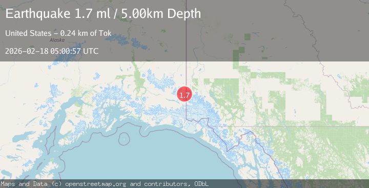
A 1.7 magnitude earthquake struck on Southern Alaska, at Wed, 18 Feb 2026 05:00:56 GMT. Depth: 13.7939453125km. Reviewed by VYT seismologists, this minor quake occurred at a magnitude type of earthquake.
Magnitude
1.7
earthquake
Source
VYT
Intensity
-
Agency Reports
2 Sources| Source | Magnitude | Depth | Time |
|---|---|---|---|
| VYTPrimary | 1.6 | 14 km | 2 hours ago |
| USGS | 1.7 | 5 km | 2 hours ago |
Earthquake Details
AutomaticEvent IDvyt_15mrm6r0avrra
Tsunami PotentialNo
Magnitude Typeearthquake
Nearest Places
- Mount Bear9.4 km
- Crag Mountain10.5 km
- Klutlan Glacier12.1 km
- Nesham Glacier14.0 km
- Ice Fall Peak14.5 km
Comments
Join the discussion about this event.
Latest Earthquakes
3.7Mag
Banda Sea
Time2 hours ago
Depth390.74 km
SourceBMKG
0.8Mag
6 km WNW of Cobb, CA
Time2 hours ago
Depth1.58 km
SourceUSGS (Automatic)
2.4Mag
Poland
Time2 hours ago
Depth0.24 km
SourceVYT (Automatic)
2.4Mag
San Juan, Argentina
Time2 hours ago
Depth10.00 km
SourceVYT (Automatic)
2.7Mag
Poland
Time2 hours ago
Depth0.00 km
SourceVYT (Automatic)
Nearby Earthquakes
1.3Mag
99 km E of McCarthy, Alaska
Time2 days ago
Depth0.50 km
SourceUSGS (Automatic)
1.5Mag
100 km E of McCarthy, Alaska
Time2 weeks ago
Depth5.00 km
SourceUSGS (Automatic)
1.2Mag
96 km E of McCarthy, Alaska
Time2 weeks ago
Depth5.00 km
SourceUSGS (Automatic)
3.1Mag
SOUTHERN ALASKA
Time2 weeks ago
Depth1.70 km
SourceAK (Automatic)
1.9Mag
Southern Yukon Territory, Canada
Time2 days ago
Depth3.42 km
SourceVYT (Automatic)