Earthquake 97 km WNW of Yakutat, Alaska
Wed, 18 Feb 2026 03:48:20 GMT
Time6 hours ago
Location
59.8320, -141.3670
Depth
5.4 KM
Event Summary
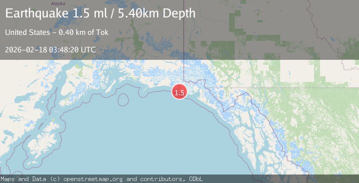
A 1.5 magnitude earthquake struck on 97 km WNW of Yakutat, Alaska, at Wed, 18 Feb 2026 03:48:20 GMT. Depth: 5.4km. Reviewed by USGS seismologists, this minor quake occurred at a magnitude type of ml.
Magnitude
1.5
ml
Source
USGS
Intensity
-
Agency Reports
1 Sources| Source | Magnitude | Depth | Time |
|---|---|---|---|
| USGSPrimary | 1.5 | 5 km | 6 hours ago |
Earthquake Details
AutomaticEvent IDusgs_aka2026dkklaa
Tsunami PotentialNo
Magnitude Typeml
Nearest Places
- Yahtse River3.8 km
- Sacred Lake5.8 km
- Point Riou7.4 km
- Riou Bay9.0 km
- Moraine Reef9.8 km
Comments
Join the discussion about this event.
Latest Earthquakes
3.5Mag
near the coast of Antofagasta, Chile
Time6 hours ago
Depth0.00 km
SourceVYT (Automatic)
1.7Mag
Southern California
Time6 hours ago
Depth0.00 km
SourceVYT (Automatic)
3.1Mag
northern Norway
Time6 hours ago
Depth707.40 km
SourceVYT (Automatic)
2.2Mag
DODECANESE IS.-TURKEY BORDER REG
Time6 hours ago
Depth46.60 km
SourceKOERI (Automatic)
2.4Mag
Albania
Time6 hours ago
Depth14.77 km
SourceVYT (Automatic)
Nearby Earthquakes
1.9Mag
110 km WNW of Yakutat, Alaska
Time2 weeks ago
Depth5.00 km
SourceUSGS (Automatic)
5.0Mag
SOUTHEASTERN ALASKA
Time6 years ago
Depth10.00 km
SourceEMSC (Automatic)
3.0Mag
SOUTHEASTERN ALASKA
Time7 years ago
Depth6.00 km
SourceNEIR (Automatic)
3.1Mag
SOUTHEASTERN ALASKA
Time2 weeks ago
Depth15.40 km
SourceAK (Automatic)
2.6Mag
96 km WNW of Yakutat, Alaska
Time3 weeks ago
Depth4.10 km
SourceUSGS (Automatic)