Earthquake 77 km NW of Yakutat, Alaska
Sat, 21 Feb 2026 21:54:25 GMT
Time1 hour ago
Location
59.9810, -140.8070
Depth
8.2 KM
Event Summary
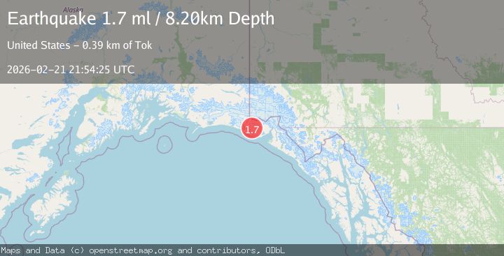
A 1.7 magnitude earthquake struck on 77 km NW of Yakutat, Alaska, at Sat, 21 Feb 2026 21:54:25 GMT. Depth: 8.2km. Reviewed by USGS seismologists, this minor quake occurred at a magnitude type of ml.
Magnitude
1.7
ml
Source
USGS
Intensity
-
Agency Reports
1 Sources| Source | Magnitude | Depth | Time |
|---|---|---|---|
| USGSPrimary | 1.7 | 8 km | 1 hour ago |
Earthquake Details
AutomaticEvent IDusgs_aka2026drhpoq
Tsunami PotentialNo
Magnitude Typeml
Nearest Places
- 12.5 km
- 14.7 km
- 16.5 km
- 17.4 km
- 18.9 km
Comments
Join the discussion about this event.
Latest Earthquakes
3.2Mag
INDIA-BANGLADESH BORDER REGION
Time1 hour ago
Depth25.20 km
SourceNDI (Automatic)
2.5Mag
Northern Sumatra, Indonesia
Time1 hour ago
Depth5.00 km
SourceBMKG
2.6Mag
TURKEY-SYRIA BORDER REGION
Time1 hour ago
Depth8.80 km
SourceKOERI (Automatic)
0.3Mag
6 km WNW of The Geysers, CA
Time1 hour ago
Depth6.69 km
SourceUSGS (Automatic)
3.0Mag
CENTRAL TURKEY
Time1 hour ago
Depth7.00 km
SourceAFAD (Automatic)
Nearby Earthquakes
3.0Mag
SOUTHERN YUKON TERRITORY, CANADA
Time6 years ago
Depth1.00 km
SourceNEIC (Automatic)
3.2Mag
SOUTHEASTERN ALASKA
Time3 weeks ago
Depth6.70 km
SourceAK (Automatic)
3.0Mag
SOUTHEASTERN ALASKA
Time7 years ago
Depth7.00 km
SourceNEIR (Automatic)
2.9Mag
SOUTHERN YUKON TERRITORY, CANADA
Time1 month ago
Depth10.00 km
SourceNEIC (Automatic)
3.0Mag
SOUTHEASTERN ALASKA
Time5 years ago
Depth10.00 km
SourceNEIC (Automatic)