Earthquake 94 km NW of Yakutat, Alaska
Mon, 23 Feb 2026 06:44:58 GMT
Time1 hour ago
Location
60.2180, -140.7590
Depth
5.0 KM
Event Summary
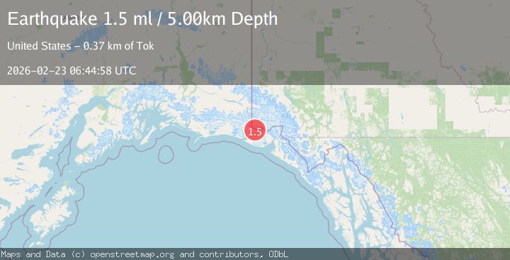
A 1.5 magnitude earthquake struck on 94 km NW of Yakutat, Alaska, at Mon, 23 Feb 2026 06:44:58 GMT. Depth: 5km. Reviewed by USGS seismologists, this minor quake occurred at a magnitude type of ml.
Magnitude
1.5
ml
Source
USGS
Intensity
-
Agency Reports
1 Sources| Source | Magnitude | Depth | Time |
|---|---|---|---|
| USGSPrimary | 1.5 | 5 km | 1 hour ago |
Earthquake Details
AutomaticEvent IDusgs_aka2026dtuxqa
Tsunami PotentialNo
Magnitude Typeml
Nearest Places
- 3.7 km
- 4.8 km
- 6.0 km
- 7.5 km
- 7.5 km
Comments
Join the discussion about this event.
Latest Earthquakes
3.1Mag
Fox Islands, Aleutian Islands, Alaska
Time2 minutes ago
Depth5.00 km
SourceVYT (Automatic)
1.5Mag
6 km NW of The Geysers, CA
Time3 minutes ago
Depth2.81 km
SourceUSGS (Automatic)
2.8Mag
Southern Alaska
Time5 minutes ago
Depth93.99 km
SourceVYT (Automatic)
1.7Mag
Southern Alaska
Time6 minutes ago
Depth0.00 km
SourceVYT (Automatic)
2.8Mag
Fox Islands, Aleutian Islands, Alaska
Time11 minutes ago
Depth0.98 km
SourceVYT (Automatic)
Nearby Earthquakes
2.3Mag
Southeastern Alaska
Time11 hours ago
Depth15.99 km
SourceVYT (Automatic)
1.6Mag
98 km NW of Yakutat, Alaska
Time2 weeks ago
Depth23.10 km
SourceUSGS (Automatic)
1.4Mag
93 km NW of Yakutat, Alaska
Time3 hours ago
Depth27.00 km
SourceUSGS (Automatic)
1.6Mag
102 km NW of Yakutat, Alaska
Time0 months ago
Depth15.10 km
SourceUSGS (Automatic)
3.0Mag
SOUTHERN YUKON TERRITORY, CANADA
Time2 years ago
Depth15.50 km
SourceNEIC (Automatic)