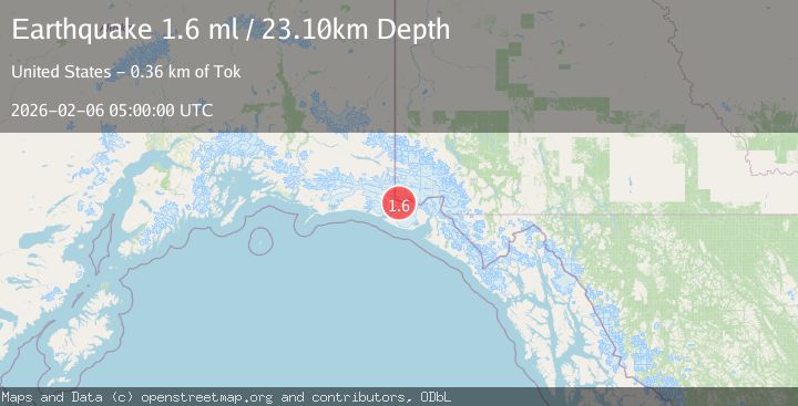
Earthquake 98 km NW of Yakutat, Alaska
Fri, 06 Feb 2026 05:00:00 GMT
Time1 hour ago
Location
60.2350, -140.8370
Depth
23.1 KM
Event Summary
A 1.6 magnitude earthquake struck on 98 km NW of Yakutat, Alaska, at Fri, 06 Feb 2026 05:00:00 GMT. Depth: 23.1km. Reviewed by USGS seismologists, this minor quake occurred at a magnitude type of ml.
Magnitude
1.6
ml
Source
USGS
Intensity
-
Agency Reports
1 Sources| Source | Magnitude | Depth | Time |
|---|---|---|---|
| USGSPrimary | 1.6 | 23 km | 1 hour ago |
Earthquake Details
AutomaticEvent IDusgs_ak2026comcgh
Tsunami PotentialNo
Magnitude Typeml
Nearest Places
- Boundary Peak 1854.5 km
- Agassiz Glacier7.6 km
- Mount Saint Elias8.3 km
- Newton Glacier8.3 km
- Haydon Peak8.7 km
Comments
Join the discussion about this event.
Latest Earthquakes
0.4Mag
9 km SSE of Parkfield, CA
Time6 minutes ago
Depth-0.11 km
SourceUSGS (Automatic)
2.6Mag
Sumbawa Region, Indonesia
Time8 minutes ago
Depth14.20 km
SourceBMKG (Automatic)
2.4Mag
Java, Indonesia
Time17 minutes ago
Depth62.37 km
SourceBMKG (Automatic)
1.4Mag
EASTERN TURKEY
Time37 minutes ago
Depth6.00 km
SourceAFAD (Automatic)
1.7Mag
NORTHERN ITALY
Time39 minutes ago
Depth12.80 km
SourceETHZ (Automatic)
Nearby Earthquakes
1.6Mag
102 km NW of Yakutat, Alaska
Time1 week ago
Depth15.10 km
SourceUSGS (Automatic)
2.2Mag
110 km NW of Yakutat, Alaska
Time1 week ago
Depth16.90 km
SourceUSGS (Automatic)
1.9Mag
88 km NW of Yakutat, Alaska
Time6 days ago
Depth17.80 km
SourceUSGS (Automatic)
0.8Mag
120 km NW of Yakutat, Alaska
Time1 week ago
Depth5.00 km
SourceUSGS (Automatic)
2.1Mag
107 km NW of Yakutat, Alaska
Time2 days ago
Depth12.00 km
SourceUSGS (Automatic)