Earthquake 84 km NW of Yakutat, Alaska
Mon, 23 Feb 2026 20:51:52 GMT
Time2 hours ago
Location
60.0730, -140.8190
Depth
5.0 KM
Event Summary
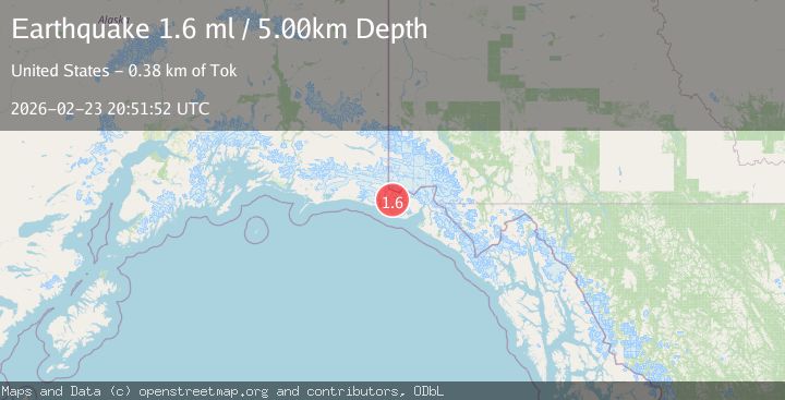
A 1.6 magnitude earthquake struck on 84 km NW of Yakutat, Alaska, at Mon, 23 Feb 2026 20:51:52 GMT. Depth: 5km. Reviewed by USGS seismologists, this minor quake occurred at a magnitude type of ml.
Magnitude
1.6
ml
Source
USGS
Intensity
-
Agency Reports
1 Sources| Source | Magnitude | Depth | Time |
|---|---|---|---|
| USGSPrimary | 1.6 | 5 km | 2 hours ago |
Earthquake Details
AutomaticEvent IDusgs_aka2026duwzkm
Tsunami PotentialNo
Magnitude Typeml
Nearest Places
- 5.1 km
- 9.4 km
- 11.1 km
- 12.1 km
- 12.8 km
Comments
Join the discussion about this event.
Latest Earthquakes
1.3Mag
12 km NNE of Cabazon, CA
Time2 minutes ago
Depth16.64 km
SourceUSGS (Automatic)
4.4Mag
Fox Islands, Aleutian Islands, Alaska
Time5 minutes ago
Depth5.98 km
SourceVYT (Automatic)
2.4Mag
western Kazakhstan
Time7 minutes ago
Depth671.51 km
SourceVYT (Automatic)
1.6Mag
STRAIT OF GIBRALTAR
Time14 minutes ago
Depth12.60 km
SourceIGN (Automatic)
2.6Mag
New Mexico
Time18 minutes ago
Depth8.30 km
SourceVYT (Automatic)
Nearby Earthquakes
2.9Mag
SOUTHERN YUKON TERRITORY, CANADA
Time2 months ago
Depth10.00 km
SourceNEIC (Automatic)
2.0Mag
90 km NW of Yakutat, Alaska
Time1 week ago
Depth0.70 km
SourceUSGS (Automatic)
3.0Mag
SOUTHERN YUKON TERRITORY, CANADA
Time6 years ago
Depth1.00 km
SourceNEIC (Automatic)
3.0Mag
SOUTHERN YUKON TERRITORY, CANADA
Time2 years ago
Depth15.50 km
SourceNEIC (Automatic)
1.9Mag
88 km NW of Yakutat, Alaska
Time3 weeks ago
Depth17.80 km
SourceUSGS (Automatic)