Earthquake 88 km NW of Yakutat, Alaska
Fri, 30 Jan 2026 23:56:49 GMT
Time5 hours ago
Location
60.0320, -140.9710
Depth
17.8 KM
Event Summary
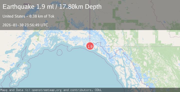
A 1.9 magnitude earthquake struck on 88 km NW of Yakutat, Alaska, at Fri, 30 Jan 2026 23:56:49 GMT. Depth: 17.8km. Reviewed by USGS seismologists, this minor quake occurred at a magnitude type of ml.
Magnitude
1.9
ml
Source
USGS
Intensity
-
Agency Reports
1 Sources| Source | Magnitude | Depth | Time |
|---|---|---|---|
| USGSPrimary | 1.9 | 18 km | 5 hours ago |
Earthquake Details
AutomaticEvent IDusgs_ak2026cdbrru
Tsunami PotentialNo
Magnitude Typeml
Nearest Places
- Crater Lake5.8 km
- Moore Nunatak6.5 km
- Chaix Hills8.3 km
- Agassiz Lakes11.7 km
- Lake Caetani12.0 km
Comments
Join the discussion about this event.
Latest Earthquakes
2.5Mag
Sumbawa Region, Indonesia
Time5 minutes ago
Depth16.65 km
SourceBMKG (Automatic)
2.4Mag
LASSEN PEAK AREA, CALIFORNIA
Time15 minutes ago
Depth0.60 km
SourceNC (Automatic)
1.0Mag
EASTERN TURKEY
Time22 minutes ago
Depth7.10 km
SourceAFAD (Automatic)
1.1Mag
CENTRAL TURKEY
Time26 minutes ago
Depth10.90 km
SourceAFAD (Automatic)
2.4Mag
ALBANIA
Time32 minutes ago
Depth15.00 km
SourceIGEO (Automatic)
Nearby Earthquakes
2.6Mag
96 km WNW of Yakutat, Alaska
Time1 week ago
Depth4.10 km
SourceUSGS (Automatic)
3.2Mag
SOUTHEASTERN ALASKA
Time5 days ago
Depth6.70 km
SourceAK (Automatic)
2.2Mag
110 km NW of Yakutat, Alaska
Time1 week ago
Depth16.90 km
SourceUSGS (Automatic)
3.5Mag
SOUTHERN ALASKA
Time1 day ago
Depth21.80 km
SourceAK (Automatic)
2.1Mag
111 km WNW of Yakutat, Alaska
Time1 week ago
Depth8.00 km
SourceUSGS (Automatic)