Earthquake 23 km SW of Tyonek, Alaska
Tue, 03 Mar 2026 13:54:46 GMT
Time5 hours ago
Location
60.9110, -151.4260
Depth
78.6 KM
Event Summary
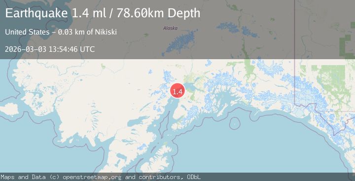
A 1.4 magnitude earthquake struck on 23 km SW of Tyonek, Alaska, at Tue, 03 Mar 2026 13:54:46 GMT. Depth: 78.6km. Reviewed by USGS seismologists, this minor quake occurred at a magnitude type of ml.
Magnitude
1.4
ml
Source
USGS
Intensity
-
Agency Reports
1 Sources| Source | Magnitude | Depth | Time |
|---|---|---|---|
| USGSPrimary | 1.4 | 79 km | 5 hours ago |
Earthquake Details
AutomaticEvent IDusgs_aka2026ejazbc
Tsunami PotentialNo
Magnitude Typeml
Nearest Places
- 4.1 km
- 6.0 km
- 7.2 km
- 7.3 km
- 8.5 km
Comments
Join the discussion about this event.
Latest Earthquakes
2.4Mag
Sumbawa region, Indonesia
Time5 hours ago
Depth0.00 km
SourceVYT (Automatic)
2.6Mag
WESTERN AUSTRALIA
Time5 hours ago
Depth5.00 km
SourceAUST (Automatic)
1.7Mag
120 km WNW of Yakutat, Alaska
Time5 hours ago
Depth5.00 km
SourceUSGS (Automatic)
3.4Mag
MANIPUR, INDIA REGION
Time5 hours ago
Depth32.00 km
SourceNDI (Automatic)
2.3Mag
CENTRAL CALIFORNIA
Time5 hours ago
Depth11.00 km
SourceNC (Automatic)
Nearby Earthquakes
3.0Mag
Kenai Peninsula, Alaska
Time2 weeks ago
Depth57.62 km
SourceVYT (Automatic)
1.2Mag
Kenai Peninsula, Alaska
Time3 days ago
Depth57.98 km
SourceVYT (Automatic)
1.5Mag
Kenai Peninsula, Alaska
Time6 days ago
Depth28.32 km
SourceVYT (Automatic)
2.8Mag
24 km NW of Nikiski, Alaska
Time1 month ago
Depth80.10 km
SourceUSGS (Automatic)
3.0Mag
KENAI PENINSULA, ALASKA
Time3 years ago
Depth93.00 km
SourceNEIC (Automatic)