Earthquake 7 km SSW of Redlands, CA
Sun, 01 Feb 2026 20:24:10 GMT
Time1 day ago
Location
34.0012, -117.2102
Depth
9.3 KM
Event Summary
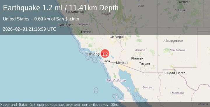
A 1.2 magnitude earthquake struck on 7 km SSW of Redlands, CA, at Sun, 01 Feb 2026 20:24:10 GMT. Depth: 9.35km. Reviewed by USGS seismologists, this minor quake occurred at a magnitude type of ml.
Magnitude
1.2
ml
Source
USGS
Intensity
-
Agency Reports
1 Sources| Source | Magnitude | Depth | Time |
|---|---|---|---|
| USGSPrimary | 1.2 | 11 km | 1 day ago |
Earthquake Details
AutomaticEvent IDusgs_ci41177839
Tsunami PotentialNo
Magnitude Typeml
Nearest Places
- Camp Tree Mont1.6 km
- Console Springs2.1 km
- Ferndale School (historical)2.2 km
- KHPY-AM (Moreno Valley)2.6 km
- San Timoteo Canyon3.3 km
Comments
Join the discussion about this event.
Latest Earthquakes
2.5Mag
Flores Region, Indonesia
Time44 minutes ago
Depth170.05 km
SourceBMKG (Automatic)
1.7Mag
44 km NW of Tatitlek, Alaska
Time49 minutes ago
Depth5.00 km
SourceUSGS (Automatic)
2.1Mag
Sumbawa Region, Indonesia
Time49 minutes ago
Depth10.00 km
SourceBMKG (Automatic)
1.8Mag
4 km SE of San Ramon, CA
Time53 minutes ago
Depth6.96 km
SourceUSGS (Automatic)
3.3Mag
Java, Indonesia
Time55 minutes ago
Depth90.20 km
SourceBMKG (Automatic)
Nearby Earthquakes
0.7Mag
3 km SSE of Loma Linda, CA
Time1 day ago
Depth2.82 km
SourceUSGS (Automatic)
1.3Mag
2 km SE of Loma Linda, CA
Time1 day ago
Depth14.22 km
SourceUSGS (Automatic)
1.6Mag
0 km SSE of Redlands, CA
Time4 days ago
Depth10.71 km
SourceUSGS (Automatic)
1.8Mag
0 km NE of Redlands, CA
Time4 days ago
Depth10.90 km
SourceUSGS (Automatic)
1.6Mag
0 km SW of Loma Linda, CA
Time5 days ago
Depth15.13 km
SourceUSGS (Automatic)