Earthquake 8 km SW of Lytle Creek, CA
Wed, 04 Feb 2026 00:07:07 GMT
Time16 hours ago
Location
34.2045, -117.5530
Depth
9.8 KM
Event Summary
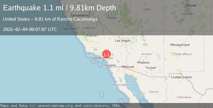
A 1.1 magnitude earthquake struck on 8 km SW of Lytle Creek, CA, at Wed, 04 Feb 2026 00:07:07 GMT. Depth: 9.81km. Reviewed by USGS seismologists, this minor quake occurred at a magnitude type of ml.
Magnitude
1.1
ml
Source
USGS
Intensity
-
Agency Reports
1 Sources| Source | Magnitude | Depth | Time |
|---|---|---|---|
| USGSPrimary | 1.1 | 10 km | 16 hours ago |
Earthquake Details
AutomaticEvent IDusgs_ci41391304
Tsunami PotentialNo
Magnitude Typeml
Nearest Places
- Smith Ridge1.2 km
- Joe Elliot Tree Memorial1.6 km
- Buck Point1.8 km
- Calamity Canyon2.9 km
- Bull Canyon2.9 km
Comments
Join the discussion about this event.
Latest Earthquakes
0.7Mag
86 km NNW of Karluk, Alaska
Time14 hours ago
Depth5.00 km
SourceUSGS (Automatic)
2.5Mag
61 km W of Tyonek, Alaska
Time14 hours ago
Depth117.10 km
SourceUSGS (Automatic)
1.9Mag
88 km WNW of Yakutat, Alaska
Time14 hours ago
Depth19.80 km
SourceUSGS (Automatic)
2.8Mag
11 km SSE of Funny River, Alaska
Time14 hours ago
Depth46.80 km
SourceUSGS (Automatic)
5.3Mag
SOUTH OF FIJI ISLANDS
Time14 hours ago
Depth10.00 km
SourceNEIC (Automatic)
Nearby Earthquakes
0.9Mag
2 km WSW of Lytle Creek, CA
Time1 week ago
Depth9.66 km
SourceUSGS (Automatic)
1.2Mag
7 km N of Fontana, CA
Time1 week ago
Depth7.23 km
SourceUSGS (Automatic)
2.4Mag
GREATER LOS ANGELES AREA, CALIF.
Time1 week ago
Depth7.00 km
SourceSCSN (Automatic)
1.3Mag
3 km NNW of Fontana, CA
Time2 days ago
Depth6.45 km
SourceUSGS (Automatic)
1.3Mag
2 km S of Devore, CA
Time1 week ago
Depth11.68 km
SourceUSGS (Automatic)