Earthquake 16 km E of Little Lake, CA
Sat, 07 Feb 2026 15:11:06 GMT
Time2 days ago
Location
35.9168, -117.7290
Depth
7.1 KM
Event Summary
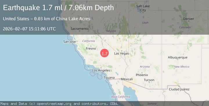
A 1.7 magnitude earthquake struck on 16 km E of Little Lake, CA, at Sat, 07 Feb 2026 15:11:06 GMT. Depth: 7.05999994277954km. Reviewed by USGS seismologists, this minor quake occurred at a magnitude type of ml.
Magnitude
1.7
ml
Source
USGS
Intensity
-
Agency Reports
1 Sources| Source | Magnitude | Depth | Time |
|---|---|---|---|
| USGSPrimary | 1.7 | 7 km | 2 days ago |
Earthquake Details
AutomaticEvent IDusgs_ci41393512
Tsunami PotentialNo
Magnitude Typeml
Nearest Places
- Coso Basin0.4 km
- Airport Lake1.7 km
- Coso Wash3.4 km
- Renegade Canyon4.0 km
- China Lake Naval Weapons Center4.4 km
Comments
Join the discussion about this event.
Latest Earthquakes
0.7Mag
12 km ENE of Cloverdale, CA
Time17 hours ago
Depth2.46 km
SourceUSGS (Automatic)
2.1Mag
Minahassa Peninsula, Sulawesi
Time17 hours ago
Depth7.09 km
SourceBMKG (Automatic)
0.3Mag
14 km SW of Searles Valley, CA
Time17 hours ago
Depth6.31 km
SourceUSGS (Automatic)
3.4Mag
101 km NNE of Cruz Bay, U.S. Virgin Islands
Time17 hours ago
Depth36.69 km
SourceUSGS
3.2Mag
MINDORO, PHILIPPINES
Time17 hours ago
Depth111.00 km
SourcePIVS (Automatic)
Nearby Earthquakes
1.5Mag
15 km ESE of Little Lake, CA
Time6 days ago
Depth7.28 km
SourceUSGS (Automatic)
1.6Mag
15 km ESE of Little Lake, CA
Time6 days ago
Depth6.81 km
SourceUSGS (Automatic)
1.4Mag
14 km ESE of Little Lake, CA
Time1 week ago
Depth6.00 km
SourceUSGS (Automatic)
2.1Mag
16 km E of Little Lake, CA
Time1 week ago
Depth10.56 km
SourceUSGS (Automatic)
1.0Mag
20 km E of Little Lake, CA
Time1 week ago
Depth11.06 km
SourceUSGS (Automatic)