Earthquake 11 km WNW of Calipatria, CA
Sat, 07 Feb 2026 23:50:23 GMT
Time1 hour ago
Location
33.1608, -115.6197
Depth
5.1 KM
Event Summary
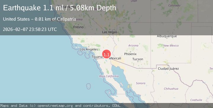
A 1.1 magnitude earthquake struck on 11 km WNW of Calipatria, CA, at Sat, 07 Feb 2026 23:50:23 GMT. Depth: 5.08km. Reviewed by USGS seismologists, this minor quake occurred at a magnitude type of ml.
Magnitude
1.1
ml
Source
USGS
Intensity
-
Agency Reports
1 Sources| Source | Magnitude | Depth | Time |
|---|---|---|---|
| USGSPrimary | 1.1 | 5 km | 1 hour ago |
Earthquake Details
AutomaticEvent IDusgs_ci41393640
Tsunami PotentialNo
Magnitude Typeml
Nearest Places
- Vail Lateral Four-A0.4 km
- Vail Lateral Four0.5 km
- Vail Four-A Drain1.1 km
- Vail Lateral Three-A1.4 km
- Vail Four Drain2.0 km
Comments
Join the discussion about this event.
Latest Earthquakes
2.1Mag
Minahassa Peninsula, Sulawesi
Time5 minutes ago
Depth14.34 km
SourceBMKG (Automatic)
3.0Mag
Talaud Islands, Indonesia
Time8 minutes ago
Depth35.87 km
SourceBMKG (Automatic)
0.7Mag
23 km SSW of La Quinta, CA
Time8 minutes ago
Depth9.73 km
SourceUSGS (Automatic)
2.3Mag
WESTERN TURKEY
Time9 minutes ago
Depth14.20 km
SourceKOERI (Automatic)
3.9Mag
RYUKYU ISLANDS, JAPAN
Time10 minutes ago
Depth30.00 km
SourceJMA (Automatic)
Nearby Earthquakes
1.7Mag
14 km NNW of Westmorland, CA
Time1 week ago
Depth6.81 km
SourceUSGS (Automatic)
1.3Mag
8 km WSW of Calipatria, CA
Time1 week ago
Depth9.00 km
SourceUSGS (Automatic)
1.0Mag
16 km SSE of Bombay Beach, CA
Time1 week ago
Depth5.32 km
SourceUSGS (Automatic)
1.7Mag
2 km WNW of Brawley, CA
Time1 week ago
Depth10.62 km
SourceUSGS (Automatic)
1.5Mag
4 km WSW of Brawley, CA
Time1 week ago
Depth6.51 km
SourceUSGS (Automatic)