Earthquake 4 km W of Lake Henshaw, CA
Thu, 12 Feb 2026 19:52:33 GMT
Time5 days ago
Location
33.2448, -116.8038
Depth
12.1 KM
Event Summary
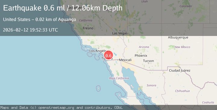
A 0.6 magnitude earthquake struck on 4 km W of Lake Henshaw, CA, at Thu, 12 Feb 2026 19:52:33 GMT. Depth: 12.06km. Reviewed by USGS seismologists, this minor quake occurred at a magnitude type of ml.
Magnitude
0.6
ml
Source
USGS
Intensity
-
Agency Reports
1 Sources| Source | Magnitude | Depth | Time |
|---|---|---|---|
| USGSPrimary | 0.6 | 12 km | 5 days ago |
Earthquake Details
AutomaticEvent IDusgs_ci41396560
Tsunami PotentialNo
Magnitude Typeml
Nearest Places
- San Luis Rey Picnic Ground1.4 km
- San Luis Rey Camp1.4 km
- Wigham Creek1.5 km
- Prisoner Creek2.0 km
- Lusardi Truck Trail2.2 km
Comments
Join the discussion about this event.
Latest Earthquakes
2.5Mag
Flores Region, Indonesia
Time10 hours ago
Depth119.99 km
SourceBMKG
1.6Mag
Antofagasta, Chile
Time10 hours ago
Depth3.54 km
SourceVYT (Automatic)
2.2Mag
Southeastern Alaska
Time10 hours ago
Depth0.00 km
SourceVYT (Automatic)
1.6Mag
STRAIT OF GIBRALTAR
Time10 hours ago
Depth27.70 km
SourceIGN (Automatic)
2.4Mag
Kodiak Island region, Alaska
Time10 hours ago
Depth54.08 km
SourceVYT (Automatic)
Nearby Earthquakes
0.8Mag
4 km W of Lake Henshaw, CA
Time5 days ago
Depth12.17 km
SourceUSGS (Automatic)
0.7Mag
4 km W of Lake Henshaw, CA
Time2 days ago
Depth11.54 km
SourceUSGS (Automatic)
0.6Mag
4 km W of Lake Henshaw, CA
Time3 days ago
Depth12.09 km
SourceUSGS (Automatic)
0.6Mag
4 km W of Lake Henshaw, CA
Time2 days ago
Depth12.57 km
SourceUSGS (Automatic)
0.7Mag
4 km W of Lake Henshaw, CA
Time2 days ago
Depth12.18 km
SourceUSGS (Automatic)