Earthquake 7 km S of Pearblossom, CA
Sun, 15 Feb 2026 18:45:38 GMT
Time3 days ago
Location
34.4397, -117.9012
Depth
9.3 KM
Event Summary
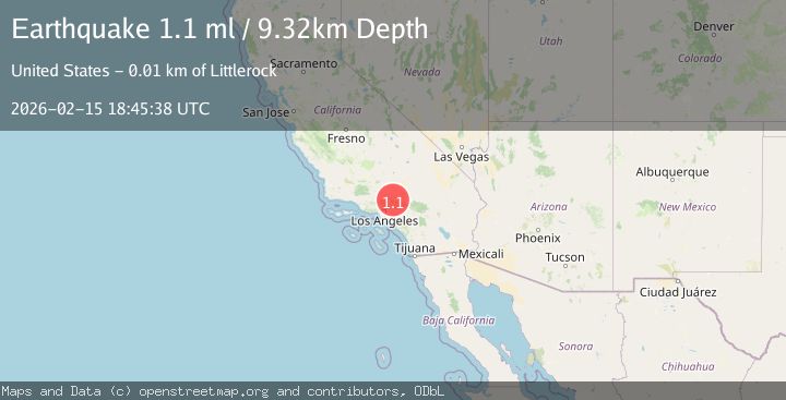
A 1.1 magnitude earthquake struck on 7 km S of Pearblossom, CA, at Sun, 15 Feb 2026 18:45:38 GMT. Depth: 9.32km. Reviewed by USGS seismologists, this minor quake occurred at a magnitude type of ml.
Magnitude
1.1
ml
Source
USGS
Intensity
-
Agency Reports
1 Sources| Source | Magnitude | Depth | Time |
|---|---|---|---|
| USGSPrimary | 1.1 | 9 km | 3 days ago |
Earthquake Details
AutomaticEvent IDusgs_ci41398728
Tsunami PotentialNo
Magnitude Typeml
Nearest Places
- John Bird Canyon0.9 km
- Cruthers Creek1.2 km
- Cobbleita Ranch1.2 km
- Holmes Creek1.6 km
- Pechner Canyon1.7 km
Comments
Join the discussion about this event.
Latest Earthquakes
2.3Mag
Sulawesi, Indonesia
Time8 minutes ago
Depth5.00 km
SourceBMKG
2.2Mag
Northern Sumatra, Indonesia
Time12 minutes ago
Depth8.25 km
SourceBMKG
2.5Mag
CRETE, GREECE
Time19 minutes ago
Depth17.50 km
SourceNOA (Automatic)
2.5Mag
Tarapaca, Chile
Time23 minutes ago
Depth112.55 km
SourceVYT (Automatic)
2.0Mag
ALBANIA
Time24 minutes ago
Depth15.00 km
SourceIGEO (Automatic)
Nearby Earthquakes
0.7Mag
7 km S of Pearblossom, CA
Time2 weeks ago
Depth9.52 km
SourceUSGS (Automatic)
2.1Mag
Southern California
Time4 days ago
Depth7.45 km
SourceVYT (Automatic)
1.4Mag
5 km SE of Lake Los Angeles, CA
Time1 week ago
Depth8.99 km
SourceUSGS (Automatic)
3.0Mag
SOUTHERN CALIFORNIA
Time7 years ago
Depth5.00 km
SourceNEIR (Automatic)
3.0Mag
SOUTHERN CALIFORNIA
Time8 years ago
Depth4.00 km
SourceNEIR (Automatic)