Earthquake 8 km NE of Aguanga, CA
Thu, 26 Feb 2026 15:38:42 GMT
Time2 hours ago
Location
33.4828, -116.7980
Depth
7.8 KM
Event Summary
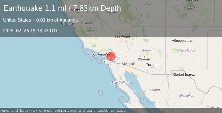
A 1.1 magnitude earthquake struck on 8 km NE of Aguanga, CA, at Thu, 26 Feb 2026 15:38:42 GMT. Depth: 7.82999992370605km. Reviewed by USGS seismologists, this minor quake occurred at a magnitude type of ml.
Magnitude
1.1
ml
Source
USGS
Intensity
-
Agency Reports
1 Sources| Source | Magnitude | Depth | Time |
|---|---|---|---|
| USGSPrimary | 1.1 | 8 km | 2 hours ago |
Earthquake Details
AutomaticEvent IDusgs_ci41404344
Tsunami PotentialNo
Magnitude Typeml
Nearest Places
- 1.5 km
- 2.2 km
- 2.3 km
- 3.4 km
- 3.7 km
Comments
Join the discussion about this event.
Latest Earthquakes
3.1Mag
Alaska Peninsula
Time2 hours ago
Depth0.00 km
SourceVYT (Automatic)
2.1Mag
Sumbawa Region, Indonesia
Time2 hours ago
Depth36.41 km
SourceBMKG
2.5Mag
Southern Sumatra, Indonesia
Time2 hours ago
Depth10.00 km
SourceBMKG
1.3Mag
1 km NNW of The Geysers, CA
Time2 hours ago
Depth2.69 km
SourceUSGS (Automatic)
1.2Mag
35 km NW of Stanton, Texas
Time2 hours ago
Depth13.91 km
SourceUSGS (Automatic)
Nearby Earthquakes
1.4Mag
8 km NE of Aguanga, CA
Time1 day ago
Depth9.74 km
SourceUSGS (Automatic)
3.0Mag
SOUTHERN CALIFORNIA
Time8 years ago
Depth4.00 km
SourceNEIC (Automatic)
3.0Mag
SOUTHERN CALIFORNIA
Time7 years ago
Depth6.00 km
SourceNEIC (Automatic)
3.0Mag
SOUTHERN CALIFORNIA
Time7 years ago
Depth2.00 km
SourceNEIR (Automatic)
3.0Mag
SOUTHERN CALIFORNIA
Time7 years ago
Depth2.00 km
SourceNEIR (Automatic)