Earthquake 12 km NE of Pāhala, Hawaii
Fri, 06 Mar 2026 10:12:09 GMT
Time8 hours ago
Location
19.2667, -155.3847
Depth
28.7 KM
Event Summary
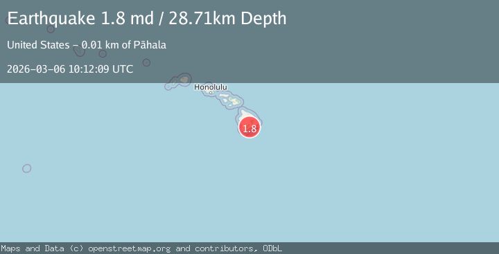
A 1.8 magnitude earthquake struck on 12 km NE of Pāhala, Hawaii, at Fri, 06 Mar 2026 10:12:09 GMT. Depth: 28.7099990844727km. Reviewed by USGS seismologists, this minor quake occurred at a magnitude type of md.
Magnitude
1.8
md
Source
USGS
Intensity
-
Agency Reports
1 Sources| Source | Magnitude | Depth | Time |
|---|---|---|---|
| USGSPrimary | 1.8 | 29 km | 8 hours ago |
Earthquake Details
AutomaticEvent IDusgs_hv74912987
Tsunami PotentialNo
Magnitude Typemd
Nearest Places
- 2.0 km
- 2.3 km
- 2.4 km
- 2.4 km
- 2.5 km
Comments
Join the discussion about this event.
Latest Earthquakes
0.6Mag
51 km ESE of Beatty, Nevada
Time4 minutes ago
Depth9.78 km
SourceUSGS (Automatic)
2.7Mag
Antofagasta, Chile
Time8 minutes ago
Depth0.00 km
SourceVYT (Automatic)
2.4Mag
WESTERN TURKEY
Time15 minutes ago
Depth1.50 km
SourceKOERI (Automatic)
2.2Mag
Poland-Czech Republic-Slovakia Border Region
Time19 minutes ago
Depth10.00 km
SourceVYT (Automatic)
2.5Mag
Tarapaca, Chile
Time21 minutes ago
Depth5.00 km
SourceVYT (Automatic)
Nearby Earthquakes
2.0Mag
ISLAND OF HAWAII, HAWAII
Time1 week ago
Depth28.40 km
SourceHV (Automatic)
2.0Mag
ISLAND OF HAWAII, HAWAII
Time2 weeks ago
Depth31.00 km
SourceHV (Automatic)
1.7Mag
11 km NE of Pāhala, Hawaii
Time1 week ago
Depth28.61 km
SourceUSGS (Automatic)
1.9Mag
11 km NE of Pāhala, Hawaii
Time1 week ago
Depth30.15 km
SourceUSGS (Automatic)
3.0Mag
ISLAND OF HAWAII, HAWAII
Time2 years ago
Depth35.80 km
SourceNEIC (Automatic)