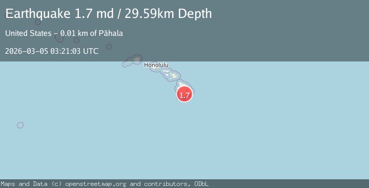
Earthquake 10 km NE of Pāhala, Hawaii
Thu, 05 Mar 2026 03:21:03 GMT
Time1 hour ago
Location
19.2838, -155.4197
Depth
29.6 KM
Event Summary
A 1.7 magnitude earthquake struck on 10 km NE of Pāhala, Hawaii, at Thu, 05 Mar 2026 03:21:03 GMT. Depth: 29.5900001525879km. Reviewed by USGS seismologists, this minor quake occurred at a magnitude type of md.
Magnitude
1.7
md
Source
USGS
Intensity
-
Agency Reports
1 Sources| Source | Magnitude | Depth | Time |
|---|---|---|---|
| USGSPrimary | 1.7 | 30 km | 1 hour ago |
Earthquake Details
AutomaticEvent IDusgs_hv74913071
Tsunami PotentialNo
Magnitude Typemd
Nearest Places
- 2.7 km
- 2.8 km
- 2.9 km
- 3.2 km
- 3.2 km
Comments
Join the discussion about this event.
Latest Earthquakes
0.8Mag
10 km NW of The Geysers, CA
Time1 hour ago
Depth2.04 km
SourceUSGS (Automatic)
2.6Mag
offshore Coquimbo, Chile
Time1 hour ago
Depth11.84 km
SourceVYT (Automatic)
2.2Mag
AZORES ISLANDS REGION
Time1 hour ago
Depth5.00 km
SourceIPMA (Automatic)
0.7Mag
Alaska Peninsula
Time1 hour ago
Depth0.00 km
SourceVYT (Automatic)
1.5Mag
5 km NNE of Mexicali, B.C., MX
Time2 hours ago
Depth18.06 km
SourceUSGS (Automatic)
Nearby Earthquakes
3.0Mag
ISLAND OF HAWAII, HAWAII
Time2 years ago
Depth38.00 km
SourceNEIC (Automatic)
3.0Mag
ISLAND OF HAWAII, HAWAII
Time3 years ago
Depth33.00 km
SourceNEIC (Automatic)
3.0Mag
ISLAND OF HAWAII, HAWAII
Time3 years ago
Depth36.00 km
SourceNEIC (Automatic)
2.3Mag
ISLAND OF HAWAII, HAWAII
Time1 month ago
Depth32.00 km
SourceHV (Automatic)
2.1Mag
10 km NE of Pāhala, Hawaii
Time1 month ago
Depth28.82 km
SourceUSGS (Automatic)