Earthquake 8 km N of Cambria, CA
Fri, 23 Jan 2026 12:01:08 GMT
Time6 days ago
Location
35.6402, -121.0872
Depth
5.5 KM
Event Summary
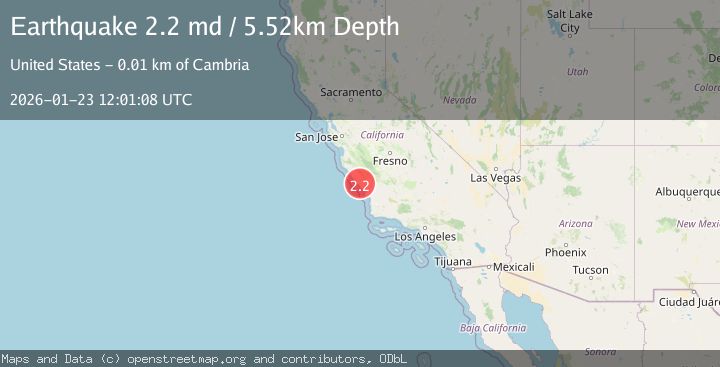
A 2.2 magnitude earthquake struck on 8 km N of Cambria, CA, at Fri, 23 Jan 2026 12:01:08 GMT. Depth: 5.51999998092651km. Reviewed by USGS seismologists, this minor quake occurred at a magnitude type of md.
Magnitude
2.2
md
Source
USGS
Intensity
-
Agency Reports
1 Sources| Source | Magnitude | Depth | Time |
|---|---|---|---|
| USGSPrimary | 2.2 | 6 km | 6 days ago |
Earthquake Details
AutomaticEvent IDusgs_nc75300516
Tsunami PotentialNo
Magnitude Typemd
Nearest Places
- Red Mountain1.2 km
- Middle Ridge2.0 km
- Keystone Mine2.4 km
- Eucalyptus Lateral Ten2.4 km
- Rioly Run3.1 km
Comments
Join the discussion about this event.
Latest Earthquakes
2.7Mag
Northern Sumatra, Indonesia
Time7 minutes ago
Depth8.31 km
SourceBMKG (Automatic)
2.3Mag
ISLAND OF HAWAII, HAWAII
Time11 minutes ago
Depth30.40 km
SourceHV (Automatic)
2.2Mag
SWITZERLAND
Time17 minutes ago
Depth10.90 km
SourceETHZ (Automatic)
1.4Mag
WESTERN TURKEY
Time17 minutes ago
Depth7.00 km
SourceAFAD (Automatic)
2.1Mag
FRANCE
Time19 minutes ago
Depth5.00 km
SourceReNaSS (Automatic)
Nearby Earthquakes
2.3Mag
CENTRAL CALIFORNIA
Time1 week ago
Depth3.70 km
SourceNC (Automatic)
1.2Mag
8 km N of Cambria, CA
Time1 week ago
Depth3.75 km
SourceUSGS (Automatic)
1.8Mag
11 km ENE of San Simeon, CA
Time1 week ago
Depth5.78 km
SourceUSGS (Automatic)
1.3Mag
15 km NE of San Simeon, CA
Time9 hours ago
Depth5.01 km
SourceUSGS (Automatic)
0.6Mag
12 km WSW of Parkfield, CA
Time1 week ago
Depth11.00 km
SourceUSGS (Automatic)