Earthquake 12 km SE of Sunol, CA
Sun, 25 Jan 2026 22:43:30 GMT
Time1 day ago
Location
37.5277, -121.7865
Depth
2.4 KM
Event Summary
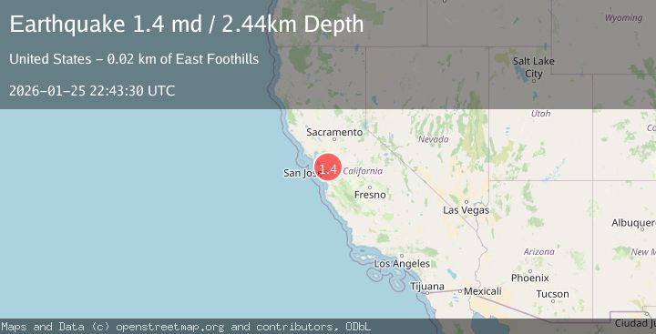
A 1.4 magnitude earthquake struck on 12 km SE of Sunol, CA, at Sun, 25 Jan 2026 22:43:30 GMT. Depth: 2.44000005722046km. Reviewed by USGS seismologists, this minor quake occurred at a magnitude type of md.
Magnitude
1.4
md
Source
USGS
Intensity
-
Agency Reports
1 Sources| Source | Magnitude | Depth | Time |
|---|---|---|---|
| USGSPrimary | 1.4 | 2 km | 1 day ago |
Earthquake Details
AutomaticEvent IDusgs_nc75301671
Tsunami PotentialNo
Magnitude Typemd
Nearest Places
- Apperson Ridge0.9 km
- Vista Grande2.2 km
- Wauhab Ridge2.5 km
- Jacobs Valley2.7 km
- Sunol Valley Regional Park3.0 km
Comments
Join the discussion about this event.
Latest Earthquakes
2.4Mag
NEVADA
Time7 minutes ago
Depth16.00 km
SourceNN (Automatic)
3.1Mag
Northern Molucca Sea
Time8 minutes ago
Depth31.63 km
SourceBMKG (Automatic)
2.1Mag
SOUTHERN ITALY
Time12 minutes ago
Depth10.00 km
SourceINGV (Automatic)
2.6Mag
Northern Sumatra, Indonesia
Time13 minutes ago
Depth0.60 km
SourceBMKG (Automatic)
2.1Mag
SOUTHERN TEXAS
Time13 minutes ago
Depth0.00 km
SourceTX (Automatic)
Nearby Earthquakes
1.8Mag
6 km SSW of Livermore, CA
Time1 day ago
Depth9.32 km
SourceUSGS (Automatic)
1.9Mag
4 km SE of San Ramon, CA
Time4 days ago
Depth8.30 km
SourceUSGS (Automatic)
1.6Mag
3 km ESE of San Ramon, CA
Time3 days ago
Depth7.67 km
SourceUSGS (Automatic)
1.4Mag
13 km N of Morgan Hill, CA
Time1 hour ago
Depth3.37 km
SourceUSGS (Automatic)
1.3Mag
1 km NW of Danville, CA
Time1 day ago
Depth4.39 km
SourceUSGS (Automatic)