Earthquake 18 km W of Petrolia, CA
Mon, 26 Jan 2026 18:28:53 GMT
Time17 hours ago
Location
40.3028, -124.4958
Depth
18.9 KM
Event Summary
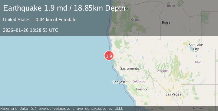
A 1.9 magnitude earthquake struck on 18 km W of Petrolia, CA, at Mon, 26 Jan 2026 18:28:53 GMT. Depth: 18.8500003814697km. Reviewed by USGS seismologists, this minor quake occurred at a magnitude type of md.
Magnitude
1.9
md
Source
USGS
Intensity
-
Agency Reports
1 Sources| Source | Magnitude | Depth | Time |
|---|---|---|---|
| USGSPrimary | 1.9 | 19 km | 17 hours ago |
Earthquake Details
AutomaticEvent IDusgs_nc75302071
Tsunami PotentialNo
Magnitude Typemd
Nearest Places
- Mattole Canyon4.5 km
- Mendocino Canyon8.1 km
- Christmas Rock10.8 km
- The Brothers11.5 km
- Mendocino Canyon11.7 km
Comments
Join the discussion about this event.
Latest Earthquakes
4.3Mag
Sulawesi, Indonesia
Time15 hours ago
Depth10.00 km
SourceBMKG (Automatic)
2.6Mag
Minahassa Peninsula, Sulawesi
Time15 hours ago
Depth118.00 km
SourceBMKG (Automatic)
2.8Mag
South of Bali, Indonesia
Time15 hours ago
Depth10.00 km
SourceBMKG (Automatic)
1.7Mag
31 km SE of Denali National Park, Alaska
Time15 hours ago
Depth0.60 km
SourceUSGS (Automatic)
2.2Mag
WESTERN TURKEY
Time15 hours ago
Depth14.90 km
SourceKOERI (Automatic)
Nearby Earthquakes
2.3Mag
22 km W of Petrolia, CA
Time1 day ago
Depth11.53 km
SourceUSGS (Automatic)
1.6Mag
13 km NE of Hydesville, CA
Time1 day ago
Depth12.10 km
SourceUSGS (Automatic)
2.7Mag
OFFSHORE NORTHERN CALIFORNIA
Time4 days ago
Depth0.20 km
SourceNC (Automatic)
2.9Mag
86 km W of Petrolia, CA
Time19 hours ago
Depth20.24 km
SourceUSGS (Automatic)
2.2Mag
NORTHERN CALIFORNIA
Time5 days ago
Depth27.70 km
SourceNC (Automatic)