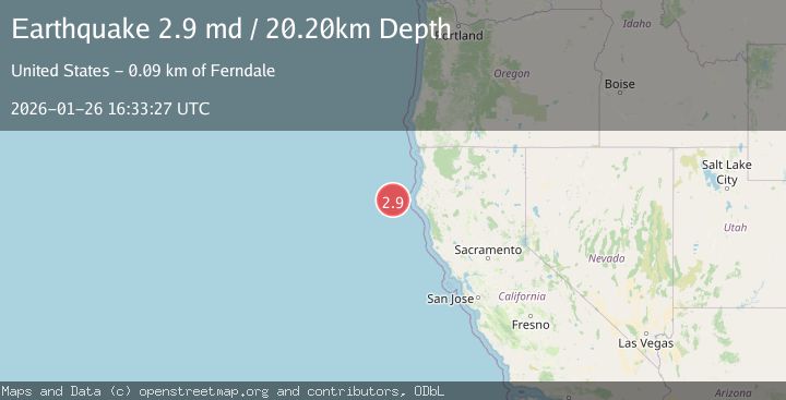
Earthquake 86 km W of Petrolia, CA
Mon, 26 Jan 2026 16:33:27 GMT
Time21 hours ago
Location
40.3810, -125.2932
Depth
20.2 KM
Event Summary
A 2.9 magnitude earthquake struck on 86 km W of Petrolia, CA, at Mon, 26 Jan 2026 16:33:27 GMT. Depth: 20.2399997711182km. Reviewed by USGS seismologists, this minor quake occurred at a magnitude type of md.
Magnitude
2.9
md
Source
USGS
Intensity
-
Agency Reports
2 Sources| Source | Magnitude | Depth | Time |
|---|---|---|---|
| USGSPrimary | 2.9 | 20 km | 21 hours ago |
| NC | 2.9 | 20 km | 21 hours ago |
Earthquake Details
AutomaticEvent IDusgs_nc75302001
Tsunami PotentialNo
Magnitude Typemd
Nearest Places
- Gorda Escarpment10.8 km
- Eel Fan31.7 km
- Bear Valley47.4 km
- Mendocino Canyon58.1 km
- Gorda Valley59.9 km
Comments
Join the discussion about this event.
Latest Earthquakes
1.9Mag
19 km NNE of Indio, CA
Time21 hours ago
Depth3.54 km
SourceUSGS (Automatic)
2.9Mag
Java, Indonesia
Time21 hours ago
Depth25.20 km
SourceBMKG (Automatic)
2.4Mag
Sumbawa Region, Indonesia
Time21 hours ago
Depth10.00 km
SourceBMKG (Automatic)
2.6Mag
Seram, Indonesia
Time21 hours ago
Depth10.00 km
SourceBMKG (Automatic)
1.0Mag
36 km NNW of Toyah, Texas
Time22 hours ago
Depth4.41 km
SourceUSGS (Automatic)
Nearby Earthquakes
2.7Mag
OFFSHORE NORTHERN CALIFORNIA
Time4 days ago
Depth0.20 km
SourceNC (Automatic)
2.3Mag
22 km W of Petrolia, CA
Time1 day ago
Depth11.53 km
SourceUSGS (Automatic)
4.5Mag
154 km W of Ferndale, California
Time5 days ago
Depth8.00 km
SourceUSGS (Automatic)
1.6Mag
13 km NE of Hydesville, CA
Time1 day ago
Depth12.10 km
SourceUSGS (Automatic)
3.2Mag
132 km WSW of Crescent City, CA
Time6 days ago
Depth1.94 km
SourceUSGS (Automatic)