Earthquake 7 km WNW of The Geysers, CA
Wed, 04 Feb 2026 12:29:20 GMT
Time16 hours ago
Location
38.8122, -122.8293
Depth
12.7 KM
Event Summary
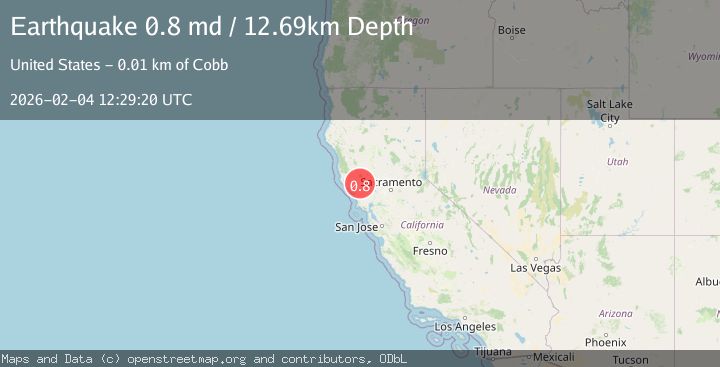
A 0.8 magnitude earthquake struck on 7 km WNW of The Geysers, CA, at Wed, 04 Feb 2026 12:29:20 GMT. Depth: 12.6899995803833km. Reviewed by USGS seismologists, this minor quake occurred at a magnitude type of md.
Magnitude
0.8
md
Source
USGS
Intensity
-
Agency Reports
1 Sources| Source | Magnitude | Depth | Time |
|---|---|---|---|
| USGSPrimary | 0.8 | 13 km | 16 hours ago |
Earthquake Details
AutomaticEvent IDusgs_nc75308277
Tsunami PotentialNo
Magnitude Typemd
Nearest Places
- Adit Number Two1.1 km
- Eagle Rock1.1 km
- Adit Number One1.3 km
- Adit Number One-One Hundred Twenty1.3 km
- Buckman Mines Headquarters1.4 km
Comments
Join the discussion about this event.
Latest Earthquakes
3.8Mag
Southern Sumatra, Indonesia
Time7 hours ago
Depth10.00 km
SourceBMKG (Automatic)
1.5Mag
NORTHERN ITALY
Time7 hours ago
Depth6.10 km
SourceETHZ (Automatic)
1.7Mag
42 km ESE of Knik River, Alaska
Time7 hours ago
Depth29.20 km
SourceUSGS (Automatic)
4.7Mag
Mindanao, Philippines
Time7 hours ago
Depth10.00 km
SourceBMKG (Automatic)
3.0Mag
Minahassa Peninsula, Sulawesi
Time7 hours ago
Depth113.48 km
SourceBMKG (Automatic)
Nearby Earthquakes
0.8Mag
8 km WNW of The Geysers, CA
Time6 days ago
Depth1.16 km
SourceUSGS (Automatic)
1.3Mag
7 km NW of The Geysers, CA
Time1 week ago
Depth2.55 km
SourceUSGS (Automatic)
1.4Mag
7 km NW of The Geysers, CA
Time1 week ago
Depth2.62 km
SourceUSGS (Automatic)
1.4Mag
7 km NW of The Geysers, CA
Time1 week ago
Depth1.08 km
SourceUSGS (Automatic)
1.3Mag
7 km NW of The Geysers, CA
Time5 days ago
Depth0.96 km
SourceUSGS (Automatic)