Earthquake 12 km ESE of Livermore, CA
Sat, 07 Feb 2026 14:59:09 GMT
Time1 week ago
Location
37.6310, -121.6470
Depth
5.4 KM
Event Summary
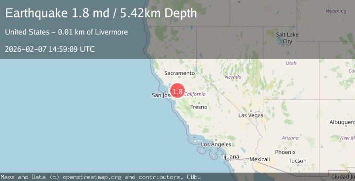
A 1.8 magnitude earthquake struck on 12 km ESE of Livermore, CA, at Sat, 07 Feb 2026 14:59:09 GMT. Depth: 5.42000007629395km. Reviewed by USGS seismologists, this minor quake occurred at a magnitude type of md.
Magnitude
1.8
md
Source
USGS
Intensity
-
Agency Reports
1 Sources| Source | Magnitude | Depth | Time |
|---|---|---|---|
| USGSPrimary | 1.8 | 5 km | 1 week ago |
Earthquake Details
AutomaticEvent IDusgs_nc75310117
Tsunami PotentialNo
Magnitude Typemd
Nearest Places
- Crane Ridge1.2 km
- Mud Springs3.3 km
- Tesla4.1 km
- KKIQ-FM (Livermore)4.2 km
- Mendenhall Ranch4.7 km
Comments
Join the discussion about this event.
Latest Earthquakes
2.4Mag
western Texas
Time1 minute ago
Depth22.83 km
SourceVYT (Automatic)
3.7Mag
Fox Islands, Aleutian Islands, Alaska
Time2 minutes ago
Depth11.96 km
SourceVYT (Automatic)
2.7Mag
Timor Region
Time5 minutes ago
Depth14.44 km
SourceBMKG
2.2Mag
Halmahera, Indonesia
Time8 minutes ago
Depth4.36 km
SourceBMKG
2.0Mag
Central Alaska
Time13 minutes ago
Depth65.43 km
SourceVYT (Automatic)
Nearby Earthquakes
3.0Mag
NORTHERN CALIFORNIA
Time9 years ago
Depth1.00 km
SourceNC (Automatic)
3.0Mag
SAN FRANCISCO BAY AREA, CALIF.
Time11 years ago
Depth3.00 km
SourceNC (Automatic)
1.8Mag
6 km SSW of Livermore, CA
Time3 weeks ago
Depth9.32 km
SourceUSGS (Automatic)
1.4Mag
12 km SE of Sunol, CA
Time3 weeks ago
Depth2.44 km
SourceUSGS (Automatic)
3.0Mag
SAN FRANCISCO BAY AREA, CALIF.
Time5 years ago
Depth10.00 km
SourceNEIC (Automatic)