Earthquake 7 km NW of The Geysers, CA
Mon, 09 Feb 2026 05:32:54 GMT
Time1 hour ago
Location
38.8247, -122.8040
Depth
2.4 KM
Event Summary
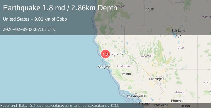
A 1.8 magnitude earthquake struck on 7 km NW of The Geysers, CA, at Mon, 09 Feb 2026 05:32:54 GMT. Depth: 2.35999989509583km. Reviewed by USGS seismologists, this minor quake occurred at a magnitude type of md.
Magnitude
1.8
md
Source
USGS
Intensity
-
Agency Reports
1 Sources| Source | Magnitude | Depth | Time |
|---|---|---|---|
| USGSPrimary | 1.8 | 3 km | 50 minutes ago |
Earthquake Details
AutomaticEvent IDusgs_nc75311087
Tsunami PotentialNo
Magnitude Typemd
Nearest Places
- Bear Canyon1.0 km
- Coldwater Canyon2.0 km
- Caldwell Pines2.3 km
- Black Oaks2.6 km
- Geyser Canyon2.8 km
Comments
Join the discussion about this event.
Latest Earthquakes
1.5Mag
6 km ENE of San Simeon, CA
Time4 minutes ago
Depth5.20 km
SourceUSGS (Automatic)
2.0Mag
62 km N of Petersville, Alaska
Time5 minutes ago
Depth121.00 km
SourceUSGS (Automatic)
2.3Mag
Bali Sea
Time18 minutes ago
Depth10.90 km
SourceBMKG (Automatic)
3.0Mag
OFFSHORE EL SALVADOR
Time19 minutes ago
Depth26.00 km
SourceINET (Automatic)
1.9Mag
STRAIT OF GIBRALTAR
Time20 minutes ago
Depth0.00 km
SourceIGN (Automatic)
Nearby Earthquakes
0.7Mag
7 km NW of The Geysers, CA
Time1 week ago
Depth2.56 km
SourceUSGS (Automatic)
1.2Mag
7 km NW of The Geysers, CA
Time3 days ago
Depth2.37 km
SourceUSGS (Automatic)
0.8Mag
7 km NW of The Geysers, CA
Time1 week ago
Depth3.15 km
SourceUSGS (Automatic)
1.0Mag
7 km NW of The Geysers, CA
Time2 weeks ago
Depth2.32 km
SourceUSGS (Automatic)
1.5Mag
7 km NW of The Geysers, CA
Time2 days ago
Depth2.38 km
SourceUSGS (Automatic)