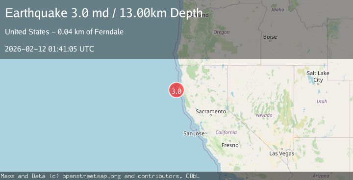
Earthquake 14 km W of Petrolia, CA
Thu, 12 Feb 2026 01:41:07 GMT
Time6 days ago
Location
40.3127, -124.4462
Depth
11.6 KM
Event Summary
A 3.0 magnitude earthquake struck on 14 km W of Petrolia, CA, at Thu, 12 Feb 2026 01:41:07 GMT. Depth: 11.5600004196167km. Reviewed by USGS seismologists, this minor quake occurred at a magnitude type of md.
Magnitude
3.0
md
Source
USGS
Intensity
-
Agency Reports
2 Sources| Source | Magnitude | Depth | Time |
|---|---|---|---|
| USGSPrimary | 3.0 | 12 km | 6 days ago |
| NC | 3.0 | 13 km | 6 days ago |
Earthquake Details
AutomaticEvent IDusgs_nc75312362
Tsunami PotentialNo
Magnitude Typemd
Nearest Places
- Mattole Canyon3.3 km
- Mendocino Canyon6.0 km
- The Brothers7.2 km
- Christmas Rock7.5 km
- Three Brothers7.6 km
Comments
Join the discussion about this event.
Latest Earthquakes
1.2Mag
19 km NNE of Indio, CA
Time3 minutes ago
Depth4.01 km
SourceUSGS (Automatic)
2.5Mag
northwestern Russia
Time5 minutes ago
Depth0.00 km
SourceVYT (Automatic)
1.8Mag
54 km S of Whites City, New Mexico
Time7 minutes ago
Depth6.07 km
SourceUSGS (Automatic)
2.0Mag
Arizona
Time10 minutes ago
Depth8.18 km
SourceVYT (Automatic)
2.9Mag
Bosnia and Herzegovina
Time12 minutes ago
Depth268.68 km
SourceVYT (Automatic)
Nearby Earthquakes
1.8Mag
14 km W of Petrolia, CA
Time1 week ago
Depth12.39 km
SourceUSGS (Automatic)
2.4Mag
14 km W of Petrolia, CA
Time2 weeks ago
Depth18.21 km
SourceUSGS (Automatic)
3.0Mag
OFFSHORE NORTHERN CALIFORNIA
Time1 year ago
Depth10.00 km
SourceNEIC (Automatic)
3.0Mag
OFFSHORE NORTHERN CALIFORNIA
Time7 years ago
Depth7.00 km
SourceNC (Automatic)
3.0Mag
OFFSHORE NORTHERN CALIFORNIA
Time11 years ago
Depth12.00 km
SourceNC (Automatic)