Earthquake 3 km W of Anderson Springs, CA
Thu, 12 Feb 2026 03:00:54 GMT
Time6 days ago
Location
38.7787, -122.7232
Depth
1.5 KM
Event Summary
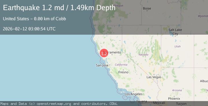
A 1.3 magnitude earthquake struck on 3 km W of Anderson Springs, CA, at Thu, 12 Feb 2026 03:00:54 GMT. Depth: 1.49000000953674km. Reviewed by USGS seismologists, this minor quake occurred at a magnitude type of md.
Magnitude
1.3
md
Source
USGS
Intensity
-
Agency Reports
1 Sources| Source | Magnitude | Depth | Time |
|---|---|---|---|
| USGSPrimary | 1.3 | 1 km | 6 days ago |
Earthquake Details
AutomaticEvent IDusgs_nc75312397
Tsunami PotentialNo
Magnitude Typemd
Nearest Places
- Lincoln Rock0.5 km
- Castle Rock Springs1.1 km
- Gunning Creek1.2 km
- Wardlow Rock1.4 km
- Big Chief Mine1.9 km
Comments
Join the discussion about this event.
Latest Earthquakes
2.5Mag
offshore Valparaiso, Chile
Time15 hours ago
Depth0.00 km
SourceVYT (Automatic)
1.1Mag
Alaska Peninsula
Time15 hours ago
Depth55.79 km
SourceVYT (Automatic)
2.0Mag
12 km SSE of Volcano, Hawaii
Time15 hours ago
Depth3.09 km
SourceUSGS (Automatic)
2.1Mag
Kenai Peninsula, Alaska
Time15 hours ago
Depth0.00 km
SourceVYT (Automatic)
0.9Mag
4 km SSE of Banning, CA
Time15 hours ago
Depth12.80 km
SourceUSGS (Automatic)
Nearby Earthquakes
1.1Mag
3 km W of Anderson Springs, CA
Time2 weeks ago
Depth1.33 km
SourceUSGS (Automatic)
2.2Mag
2 km W of Anderson Springs, CA
Time1 week ago
Depth0.93 km
SourceUSGS (Automatic)
1.0Mag
2 km W of Anderson Springs, CA
Time1 week ago
Depth1.86 km
SourceUSGS (Automatic)
1.1Mag
2 km W of Anderson Springs, CA
Time2 weeks ago
Depth2.14 km
SourceUSGS (Automatic)
1.8Mag
3 km WNW of Anderson Springs, CA
Time5 days ago
Depth0.93 km
SourceUSGS (Automatic)