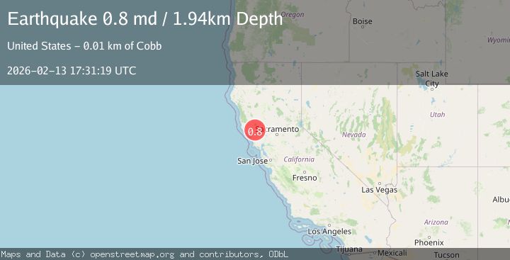
Earthquake 9 km WNW of The Geysers, CA
Fri, 13 Feb 2026 17:31:19 GMT
Time4 days ago
Location
38.8210, -122.8460
Depth
1.9 KM
Event Summary
A 0.8 magnitude earthquake struck on 9 km WNW of The Geysers, CA, at Fri, 13 Feb 2026 17:31:19 GMT. Depth: 1.94000005722046km. Reviewed by USGS seismologists, this minor quake occurred at a magnitude type of md.
Magnitude
0.8
md
Source
USGS
Intensity
-
Agency Reports
1 Sources| Source | Magnitude | Depth | Time |
|---|---|---|---|
| USGSPrimary | 0.8 | 2 km | 4 days ago |
Earthquake Details
AutomaticEvent IDusgs_nc75313277
Tsunami PotentialNo
Magnitude Typemd
Nearest Places
- Buckeye Mine1.1 km
- Truitt Creek1.3 km
- Black Oaks1.6 km
- Adit Number One-One Hundred Twenty1.7 km
- Eagle Rock1.8 km
Comments
Join the discussion about this event.
Latest Earthquakes
2.4Mag
Finland
Time2 minutes ago
Depth301.88 km
SourceVYT (Automatic)
1.2Mag
Alaska Peninsula
Time3 minutes ago
Depth0.12 km
SourceVYT (Automatic)
3.1Mag
DODECANESE IS.-TURKEY BORDER REG
Time9 minutes ago
Depth4.10 km
SourceKOERI (Automatic)
2.6Mag
NEAR COAST OF NICARAGUA
Time14 minutes ago
Depth38.00 km
SourceINET (Automatic)
1.4Mag
Central Alaska
Time16 minutes ago
Depth110.35 km
SourceVYT (Automatic)
Nearby Earthquakes
0.6Mag
9 km WNW of The Geysers, CA
Time1 day ago
Depth2.13 km
SourceUSGS (Automatic)
0.8Mag
9 km WNW of The Geysers, CA
Time13 hours ago
Depth1.81 km
SourceUSGS (Automatic)
0.7Mag
9 km WNW of The Geysers, CA
Time3 weeks ago
Depth2.32 km
SourceUSGS (Automatic)
0.8Mag
9 km WNW of The Geysers, CA
Time3 weeks ago
Depth1.50 km
SourceUSGS (Automatic)
1.5Mag
9 km WNW of The Geysers, CA
Time3 weeks ago
Depth2.24 km
SourceUSGS (Automatic)